Contrexéville geodata
Contrexéville (Grand Est) is a populated place; located in France in Europe/Paris (GMT+2) time zone. With population of 4,181 people, there are 2349 cities with bigger population in this country. Compared to other cities in France, 62.6% of cities are located further ↓South; 85.9% of cities are located further ←West and 85.3% of cities have lower elevation than Contrexéville. Note1
Administrative division(s):
- Level 1: Grand Est
- Level 2: Vosges
- Level 3: Arrondissement de Neufchâteau
- Level 4: Contrexéville


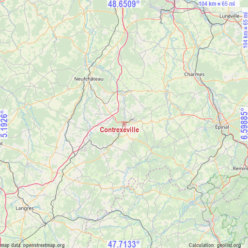
Contrexéville GPS coordinates[2]
48° 11' 3.264" North, 5° 53' 44.592" East
| Map corner | latitude | longitude |
|---|---|---|
| Upper-left | 48.6509°, | 5.1926° |
| Center: | 48.18424°, | 5.89572° |
| Lower-right: | 47.7133°, | 6.59885° |
| Map W x H: | 104.3×104.2 km | = 64.8×64.7mi |
| max Lat: | 51.07786° ⇑37.4% North |
| Contrexéville: | 48.18424° |
| min Lat: | ⇓62.6% South 41.3874° |
| min Long | Contrexéville | max Long |
| -5.08615° | 5.89572° | 9.52242° |
| W 85.9%⇐ | ⇒14.1% E |
Elevation
Elevation of Contrexéville is 350 m = 1148 ft, and this is 156.3 m = 513 ft above average elevation for this country.
| Max E: |
2333 m = 7654 ft | 14.7% |
| Contrexéville | 350 m 1148 ft | |
| Avg. | 193.7 m = 635 ft | |
Min E: |
-1 m = -3 ft | 85.3% |
See also: France elevation on elevation.city.
Geographical zone
Contrexéville is located in North temperate zone (between Tropic of Cancer and the Arctic Circle). Distance of this North polar circle is 2043.6 km =1269.8 mi to North.| Distance of | km | miles | from Contrexéville |
|---|---|---|---|
| North Pole | 4649.5 | 2889.1 | to North |
| Arctic Circle | 2043.6 | 1269.8 | to North |
| Tropic Cancer | 2751.7 | 1709.8 | to South |
| Equator | 5357.6 | 3329.1 | to South |


Nearby cities:
15 places around Contrexéville: (largest is in red/bold)
• Bazoilles-sur-Meuse
22.1 km =13.7 mi,  307°
307°
• Breuvannes-en-Bassigny
22.7 km =14.1 mi,  245°
245°
• Bulgnéville
5.2 km =3.2 mi,  299°
299°
• Châtenois
14 km =8.7 mi,  340°
340°
• Darney
15.7 km =9.8 mi,  133°
133°
• Gironcourt-sur-Vraine
14.4 km =8.9 mi,  11°
11°
• Hymont
20.4 km =12.7 mi,  63°
63°
• Lamarche
15.3 km =9.5 mi,  213°
213°
• Martigny-les-Bains
10.3 km =6.4 mi, 211°
• Mattaincourt
20.5 km =12.7 mi, 58°
• Mirecourt
21.8 km =13.5 mi,  53°
53°
• Monthureux-sur-Saône
17.7 km =11 mi,  160°
160°
• Poussay
22.6 km =14 mi, 48°
• Remoncourt
12.6 km =7.8 mi,  66°
66°
• Vittel
4.3 km =2.7 mi, 64°
Sources, notices
• [Note1] Compared only with cities in France existing in our database
• [Src1] Map data: © OpenStreetMap contributors (CC-BY-SA)
• [Src2] Other city data from geonames.org with taken over terms of usage.
• [Src3] Geographical zone / Annual Mean Temperature by Robert A. Rohde @ Wikipedia
