Bulgnéville geodata
Bulgnéville (Grand Est) is a populated place; located in France in Europe/Paris (GMT+2) time zone. With population of 1,433 people, there are 6466 cities with bigger population in this country. Compared to other cities in France, 62.9% of cities are located further ↓South; 85.4% of cities are located further ←West and 85.4% of cities have lower elevation than Bulgnéville. Note1
Administrative division(s):
- Level 1: Grand Est
- Level 2: Vosges
- Level 3: Arrondissement de Neufchâteau
- Level 4: Bulgnéville


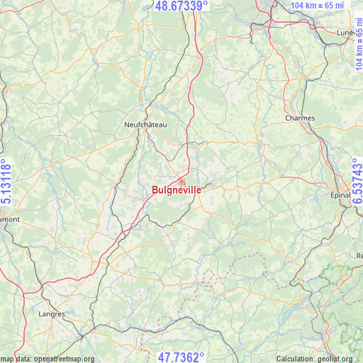
Bulgnéville GPS coordinates[2]
48° 12' 24.984" North, 5° 50' 3.48" East
| Map corner | latitude | longitude |
|---|---|---|
| Upper-left | 48.67339°, | 5.13118° |
| Center: | 48.20694°, | 5.8343° |
| Lower-right: | 47.7362°, | 6.53743° |
| Map W x H: | 104.2×104.2 km | = 64.7×64.7mi |
| max Lat: | 51.07786° ⇑37.1% North |
| Bulgnéville: | 48.20694° |
| min Lat: | ⇓62.9% South 41.3874° |
| min Long | Bulgnéville | max Long |
| -5.08615° | 5.8343° | 9.52242° |
| W 85.4%⇐ | ⇒14.6% E |
Elevation
Elevation of Bulgnéville is 351 m = 1152 ft, and this is 157.3 m = 516 ft above average elevation for this country.
| Max E: |
2333 m = 7654 ft | 14.6% |
| Bulgnéville | 351 m 1152 ft | |
| Avg. | 193.7 m = 635 ft | |
Min E: |
-1 m = -3 ft | 85.4% |
See also: France elevation on elevation.city.
Geographical zone
Bulgnéville is located in North temperate zone (between Tropic of Cancer and the Arctic Circle). Distance of this North polar circle is 2041.1 km =1268.3 mi to North.| Distance of | km | miles | from Bulgnéville |
|---|---|---|---|
| North Pole | 4647 | 2887.5 | to North |
| Arctic Circle | 2041.1 | 1268.3 | to North |
| Tropic Cancer | 2754.2 | 1711.4 | to South |
| Equator | 5360.1 | 3330.6 | to South |


Nearby cities:
15 places around Bulgnéville: (largest is in red/bold)
• Bazoilles-sur-Meuse
17 km =10.6 mi,  309°
309°
• Bourmont
18.2 km =11.3 mi,  265°
265°
• Breuvannes-en-Bassigny
20 km =12.4 mi,  233°
233°
• Châtenois
10.7 km =6.6 mi,  358°
358°
• Contrexéville
5.2 km =3.2 mi,  119°
119°
• Darney
20.8 km =12.9 mi,  130°
130°
• Gironcourt-sur-Vraine
13.7 km =8.5 mi,  32°
32°
• Lamarche
15.8 km =9.8 mi,  194°
194°
• Liffol-le-Grand
22.4 km =13.9 mi,  303°
303°
• Martigny-les-Bains
11.4 km =7.1 mi,  184°
184°
• Monthureux-sur-Saône
21.8 km =13.5 mi,  151°
151°
• Neufchâteau
19.4 km =12.1 mi,  328°
328°
• Remoncourt
16.3 km =10.1 mi,  81°
81°
• Soulosse-sous-Saint-Élophe
22.7 km =14.1 mi,  340°
340°
• Vittel
8.5 km =5.3 mi,  94°
94°
Sources, notices
• [Note1] Compared only with cities in France existing in our database
• [Src1] Map data: © OpenStreetMap contributors (CC-BY-SA)
• [Src2] Other city data from geonames.org with taken over terms of usage.
• [Src3] Geographical zone / Annual Mean Temperature by Robert A. Rohde @ Wikipedia
