Condé-sur-Vesgre geodata
Condé-sur-Vesgre (Île-de-France) is a populated place; located in France in Europe/Paris (GMT+2) time zone. With population of 1,095 people, there are 8159 cities with bigger population in this country. Compared to other cities in France, 74.1% of cities are located further ↓South; 60.9% of cities are located further →East and 57.3% of cities have higher elevation than Condé-sur-Vesgre. Note1
Administrative division(s):
- Level 1: Île-de-France
- Level 2: Yvelines
- Level 3: Arrondissement de Mantes-la-Jolie
- Level 4: Condé-sur-Vesgre


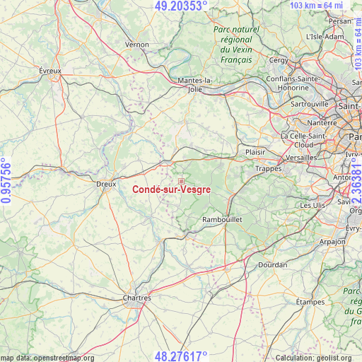
Condé-sur-Vesgre GPS coordinates[2]
48° 44' 31.164" North, 1° 39' 38.484" East
| Map corner | latitude | longitude |
|---|---|---|
| Upper-left | 49.20353°, | 0.95756° |
| Center: | 48.74199°, | 1.66069° |
| Lower-right: | 48.27617°, | 2.36381° |
| Map W x H: | 103.1×103.1 km | = 64.1×64.1mi |
| max Lat: | 51.07786° ⇑25.9% North |
| Condé-sur-Vesgre: | 48.74199° |
| min Lat: | ⇓74.1% South 41.3874° |
| min Long | Condé-sur-Vesg | max Long |
| -5.08615° | 1.66069° | 9.52242° |
| W 39.1%⇐ | ⇒60.9% E |
Elevation
Elevation of Condé-sur-Vesgre is 110 m = 361 ft, and this is 83.7 m = 275 ft below average elevation for this country.
| Max E: |
2333 m = 7654 ft | 57.3% |
| Avg. | 193.7 m = 635 ft | |
| Condé-sur-Vesgre | 110 m = 361 ft | |
Min E: |
-1 m = -3 ft | 42.7% |
See also: France elevation on elevation.city.
Geographical zone
Condé-sur-Vesgre is located in North temperate zone (between Tropic of Cancer and the Arctic Circle). Distance of this North polar circle is 1981.6 km =1231.3 mi to North.| Distance of | km | miles | from Condé-sur-Vesgre |
|---|---|---|---|
| North Pole | 4587.5 | 2850.5 | to North |
| Arctic Circle | 1981.6 | 1231.3 | to North |
| Tropic Cancer | 2813.7 | 1748.4 | to South |
| Equator | 5419.6 | 3367.6 | to South |


Nearby cities:
15 places around Condé-sur-Vesgre: (largest is in red/bold)
• Adainville
2.1 km =1.3 mi,  194°
194°
• Bazainville
7 km =4.3 mi,  4°
4°
• Broué
10.1 km =6.3 mi,  274°
274°
• Gambais
3.6 km =2.2 mi,  13°
13°
• Goussainville
8.6 km =5.3 mi,  296°
296°
• Grosrouvre
8.6 km =5.3 mi,  58°
58°
• Houdan
7 km =4.3 mi,  320°
320°
• La Boissière-École
6.9 km =4.3 mi, 185°
• La Queue-les-Yvelines
10.1 km =6.3 mi,  50°
50°
• Maulette
6.3 km =3.9 mi,  333°
333°
• Mittainville
8 km =5 mi, 187°
• Perdreauville
6.3 km =3.9 mi, 14°
• Poigny-la-Forêt
9.8 km =6.1 mi,  134°
134°
• Saint-Léger-en-Yvelines
8.1 km =5 mi,  106°
106°
• Tacoignières
10.5 km =6.5 mi, 5°
Sources, notices
• [Note1] Compared only with cities in France existing in our database
• [Src1] Map data: © OpenStreetMap contributors (CC-BY-SA)
• [Src2] Other city data from geonames.org with taken over terms of usage.
• [Src3] Geographical zone / Annual Mean Temperature by Robert A. Rohde @ Wikipedia
