Colleville geodata
Colleville (Normandy) is a populated place; located in France in Europe/Paris (GMT+2) time zone. With population of 699 people, there are 11810 cities with bigger population in this country. Compared to other cities in France, 91.9% of cities are located further ↓South; 73.8% of cities are located further →East and 89.1% of cities have higher elevation than Colleville. Note1
Administrative division(s):
- Level 1: Normandy
- Level 2: Seine-Maritime
- Level 3: Arrondissement du Havre
- Level 4: Colleville


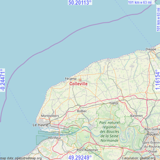
Colleville GPS coordinates[2]
49° 44' 56.184" North, 0° 27' 30.312" East
| Map corner | latitude | longitude |
|---|---|---|
| Upper-left | 50.20113°, | -0.24471° |
| Center: | 49.74894°, | 0.45842° |
| Lower-right: | 49.29249°, | 1.16154° |
| Map W x H: | 101×101 km | = 62.8×62.8mi |
| max Lat: | 51.07786° ⇑8.1% North |
| Colleville: | 49.74894° |
| min Lat: | ⇓91.9% South 41.3874° |
| min Long | Colleville | max Long |
| -5.08615° | 0.45842° | 9.52242° |
| W 26.2%⇐ | ⇒73.8% E |
Elevation
Elevation of Colleville is 32 m = 105 ft, and this is 161.7 m = 531 ft below average elevation for this country.
| Max E: |
2333 m = 7654 ft | 89.1% |
| Avg. | 193.7 m = 635 ft | |
| Colleville | 32 m = 105 ft | |
Min E: |
-1 m = -3 ft | 10.9% |
See also: France elevation on elevation.city.
Geographical zone
Colleville is located in North temperate zone (between Tropic of Cancer and the Arctic Circle). Distance of this North polar circle is 1869.6 km =1161.7 mi to North.| Distance of | km | miles | from Colleville |
|---|---|---|---|
| North Pole | 4475.5 | 2780.9 | to North |
| Arctic Circle | 1869.6 | 1161.7 | to North |
| Tropic Cancer | 2925.6 | 1817.9 | to South |
| Equator | 5531.6 | 3437.2 | to South |


Nearby cities:
15 places around Colleville: (largest is in red/bold)
• Angerville-la-Martel
3.5 km =2.2 mi,  66°
66°
• Bec-de-Mortagne
5.3 km =3.3 mi,  187°
187°
• Bretteville-du-Grand-Caux
10.1 km =6.3 mi,  204°
204°
• Froberville
9.4 km =5.8 mi,  251°
251°
• Fécamp
6.1 km =3.8 mi,  279°
279°
• Saint-Léonard
7.2 km =4.5 mi,  264°
264°
• Saint-Pierre-en-Port
6.9 km =4.3 mi,  23°
23°
• Sainte-Hélène-Bondeville
2.9 km =1.8 mi,  3°
3°
• Sassetot-le-Mauconduit
8 km =5 mi,  38°
38°
• Senneville-sur-Fécamp
4 km =2.5 mi,  309°
309°
• Tourville-les-Ifs
5.7 km =3.5 mi,  226°
226°
• Toussaint
2.8 km =1.7 mi,  243°
243°
• Valmont
4 km =2.5 mi,  98°
98°
• Életot
4.4 km =2.7 mi,  352°
352°
• Épreville
8.2 km =5.1 mi, 234°
Sources, notices
• [Note1] Compared only with cities in France existing in our database
• [Src1] Map data: © OpenStreetMap contributors (CC-BY-SA)
• [Src2] Other city data from geonames.org with taken over terms of usage.
• [Src3] Geographical zone / Annual Mean Temperature by Robert A. Rohde @ Wikipedia
