Jouars-Pontchartrain geodata
Jouars-Pontchartrain (Île-de-France) is a populated place; located in France in Europe/Paris (GMT+2) time zone. With population of 5,012 people, there are 1976 cities with bigger population in this country. Compared to other cities in France, 75.3% of cities are located further ↓South; 58.3% of cities are located further →East and 60.8% of cities have higher elevation than Jouars-Pontchartrain. Note1
Administrative division(s):
- Level 1: Île-de-France
- Level 2: Yvelines
- Level 3: Arrondissement de Rambouillet
- Level 4: Jouars-Pontchartrain
Current local time in Jouars-Pontchartrain:
04:33 AM, WednesdayDifference from your time zone: hours


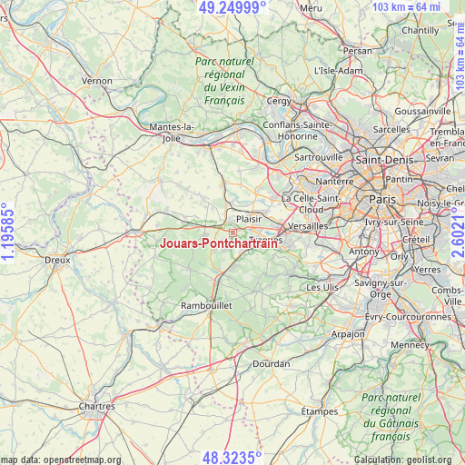
Jouars-Pontchartrain GPS coordinates[2]
48° 47' 19.968" North, 1° 53' 56.328" East
| Map corner | latitude | longitude |
|---|---|---|
| Upper-left | 49.24999°, | 1.19585° |
| Center: | 48.78888°, | 1.89898° |
| Lower-right: | 48.3235°, | 2.6021° |
| Map W x H: | 103×103 km | = 64×64mi |
| max Lat: | 51.07786° ⇑24.7% North |
| Jouars-Pontchartrain: | 48.78888° |
| min Lat: | ⇓75.3% South 41.3874° |
| min Long | Jouars-Pontchar | max Long |
| -5.08615° | 1.89898° | 9.52242° |
| W 41.7%⇐ | ⇒58.3% E |
Elevation
Elevation of Jouars-Pontchartrain is 100 m = 328 ft, and this is 93.7 m = 307 ft below average elevation for this country.
| Max E: |
2333 m = 7654 ft | 60.8% |
| Avg. | 193.7 m = 635 ft | |
| Jouars-Pontchartrain | 100 m = 328 ft | |
Min E: |
-1 m = -3 ft | 39.2% |
See also: France elevation on elevation.city.
Geographical zone
Jouars-Pontchartrain is located in North temperate zone (between Tropic of Cancer and the Arctic Circle). Distance of this North polar circle is 1976.4 km =1228.1 mi to North.| Distance of | km | miles | from Jouars-Pontchartrain |
|---|---|---|---|
| North Pole | 4582.2 | 2847.2 | to North |
| Arctic Circle | 1976.4 | 1228.1 | to North |
| Tropic Cancer | 2818.9 | 1751.6 | to South |
| Equator | 5424.8 | 3370.8 | to South |


Nearby cities:
15 places around Jouars-Pontchartrain: (largest is in red/bold)
• Bazoches-sur-Guyonne
3.4 km =2.1 mi,  249°
249°
• Coignières
4.6 km =2.9 mi,  159°
159°
• La Verrière
5.4 km =3.4 mi,  139°
139°
• Le Mesnil-Saint-Denis
6.4 km =4 mi, 139°
• Le Tremblay-sur-Mauldre
1.9 km =1.2 mi,  232°
232°
• Les Mesnuls
5.4 km =3.4 mi, 227°
• Maurepas
3.5 km =2.2 mi, 140°
• Méré
6.4 km =4 mi,  265°
265°
• Neauphle-le-Château
2.9 km =1.8 mi,  9°
9°
• Neauphle-le-Vieux
4 km =2.5 mi,  317°
317°
• Plaisir
5.6 km =3.5 mi,  46°
46°
• Saint-Germain-de-la-Grange
5.1 km =3.2 mi,  359°
359°
• Thiverval-Grignon
6.9 km =4.3 mi, 11°
• Villiers-Saint-Fréderic
3.3 km =2.1 mi,  339°
339°
• Élancourt
4.2 km =2.6 mi,  97°
97°
Sources, notices
• [Note1] Compared only with cities in France existing in our database
• [Src1] Map data: © OpenStreetMap contributors (CC-BY-SA)
• [Src2] Other city data from geonames.org with taken over terms of usage.
• [Src3] Geographical zone / Annual Mean Temperature by Robert A. Rohde @ Wikipedia
