Cintegabelle geodata
Cintegabelle (Occitanie) is a populated place; located in France in Europe/Paris (GMT+2) time zone. With population of 2,516 people, there are 3876 cities with bigger population in this country. Compared to other cities in France, 95.4% of cities are located further ↑North; 62.6% of cities are located further →East and 70.4% of cities have lower elevation than Cintegabelle. Note1
Administrative division(s):
- Level 1: Occitanie
- Level 2: Haute-Garonne
- Level 3: Arrondissement de Muret
- Level 4: Cintegabelle


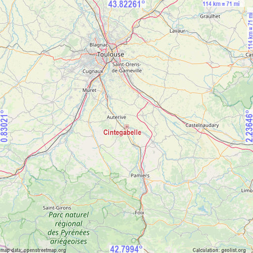
Cintegabelle GPS coordinates[2]
43° 18' 47.376" North, 1° 31' 59.988" East
| Map corner | latitude | longitude |
|---|---|---|
| Upper-left | 43.82261°, | 0.83021° |
| Center: | 43.31316°, | 1.53333° |
| Lower-right: | 42.7994°, | 2.23646° |
| Map W x H: | 113.8×113.8 km | = 70.7×70.7mi |
| max Lat: | 51.07786° ⇑95.4% North |
| Cintegabelle: | 43.31316° |
| min Lat: | ⇓4.6% South 41.3874° |
| min Long | Cintegabelle | max Long |
| -5.08615° | 1.53333° | 9.52242° |
| W 37.4%⇐ | ⇒62.6% E |
Elevation
Elevation of Cintegabelle is 221 m = 725 ft, and this is 27.3 m = 90 ft above average elevation for this country.
| Max E: |
2333 m = 7654 ft | 29.6% |
| Cintegabelle | 221 m 725 ft | |
| Avg. | 193.7 m = 635 ft | |
Min E: |
-1 m = -3 ft | 70.4% |
See also: France elevation on elevation.city.
Geographical zone
Cintegabelle is located in North temperate zone (between Tropic of Cancer and the Arctic Circle). Distance of this Northern Tropic circle is 2210.1 km =1373.3 mi to South.| Distance of | km | miles | from Cintegabelle |
|---|---|---|---|
| North Pole | 5191.1 | 3225.6 | to North |
| Arctic Circle | 2585.2 | 1606.4 | to North |
| Tropic Cancer | 2210.1 | 1373.3 | to South |
| Equator | 4816 | 2992.5 | to South |


Nearby cities:
15 places around Cintegabelle: (largest is in red/bold)
• Auterive
6.1 km =3.8 mi,  313°
313°
• Ayguesvives
14.6 km =9.1 mi,  20°
20°
• Calmont
8.4 km =5.2 mi,  110°
110°
• Gaillac-Toulza
8.1 km =5 mi,  217°
217°
• Gardouch
14.9 km =9.3 mi,  54°
54°
• Grépiac
12.3 km =7.6 mi,  325°
325°
• Le Vernet
15.3 km =9.5 mi,  158°
158°
• Mazères
13.6 km =8.5 mi,  120°
120°
• Miremont
11.3 km =7 mi,  303°
303°
• Montesquieu-Lauragais
13.9 km =8.6 mi,  34°
34°
• Nailloux
8.8 km =5.5 mi,  55°
55°
• Saint-Léon
10 km =6.2 mi,  12°
12°
• Saint-Ybars
14.6 km =9.1 mi,  234°
234°
• Saverdun
9.3 km =5.8 mi, 159°
• Venerque
15.2 km =9.4 mi, 332°
Sources, notices
• [Note1] Compared only with cities in France existing in our database
• [Src1] Map data: © OpenStreetMap contributors (CC-BY-SA)
• [Src2] Other city data from geonames.org with taken over terms of usage.
• [Src3] Geographical zone / Annual Mean Temperature by Robert A. Rohde @ Wikipedia
