Chevrières geodata
Chevrières (Auvergne-Rhône-Alpes) is a populated place; located in France in Europe/Paris (GMT+2) time zone. With population of 609 people, there are 13174 cities with bigger population in this country. Compared to other cities in France, 77.6% of cities are located further ↑North; 80.5% of cities are located further ←West and 88.8% of cities have lower elevation than Chevrières. Note1
Administrative division(s):
- Level 1: Auvergne-Rhône-Alpes
- Level 2: Département de l'Isère
- Level 3: Arrondissement de Grenoble
- Level 4: Chevrières


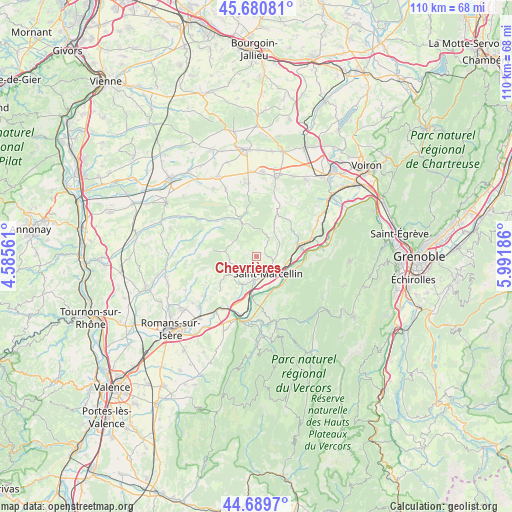
Chevrières GPS coordinates[2]
45° 11' 14.676" North, 5° 17' 19.464" East
| Map corner | latitude | longitude |
|---|---|---|
| Upper-left | 45.68081°, | 4.58561° |
| Center: | 45.18741°, | 5.28874° |
| Lower-right: | 44.6897°, | 5.99186° |
| Map W x H: | 110.2×110.2 km | = 68.5×68.5mi |
| max Lat: | 51.07786° ⇑77.6% North |
| Chevrières: | 45.18741° |
| min Lat: | ⇓22.4% South 41.3874° |
| min Long | Chevrières | max Long |
| -5.08615° | 5.28874° | 9.52242° |
| W 80.5%⇐ | ⇒19.5% E |
Elevation
Elevation of Chevrières is 403 m = 1322 ft, and this is 209.3 m = 687 ft above average elevation for this country.
| Max E: |
2333 m = 7654 ft | 11.2% |
| Chevrières | 403 m 1322 ft | |
| Avg. | 193.7 m = 635 ft | |
Min E: |
-1 m = -3 ft | 88.8% |
See also: France elevation on elevation.city.
Geographical zone
Chevrières is located in North temperate zone (between Tropic of Cancer and the Arctic Circle). Distance of this North polar circle is 2376.8 km =1476.9 mi to North.| Distance of | km | miles | from Chevrières |
|---|---|---|---|
| North Pole | 4982.7 | 3096.1 | to North |
| Arctic Circle | 2376.8 | 1476.9 | to North |
| Tropic Cancer | 2418.5 | 1502.8 | to South |
| Equator | 5024.4 | 3122 | to South |


Nearby cities:
15 places around Chevrières: (largest is in red/bold)
• Beaulieu
8.3 km =5.2 mi,  96°
96°
• Chatte
5 km =3.1 mi,  185°
185°
• Cognin-les-Gorges
9.8 km =6.1 mi, 101°
• Izeron
8.1 km =5 mi,  126°
126°
• La Sône
8.5 km =5.3 mi, 185°
• Roybon
8.6 km =5.3 mi,  336°
336°
• Saint-Antoine-l'Abbaye
6.1 km =3.8 mi,  247°
247°
• Saint-Bonnet-de-Chavagne
8.2 km =5.1 mi,  213°
213°
• Saint-Marcellin
4.8 km =3 mi,  152°
152°
• Saint-Romans
8.7 km =5.4 mi,  162°
162°
• Saint-Sauveur
6.3 km =3.9 mi, 127°
• Saint-Vérand
3.8 km =2.4 mi,  114°
114°
• Têche
7 km =4.3 mi, 95°
• Varacieux
6.3 km =3.9 mi,  36°
36°
• Vinay
9.5 km =5.9 mi,  75°
75°
Sources, notices
• [Note1] Compared only with cities in France existing in our database
• [Src1] Map data: © OpenStreetMap contributors (CC-BY-SA)
• [Src2] Other city data from geonames.org with taken over terms of usage.
• [Src3] Geographical zone / Annual Mean Temperature by Robert A. Rohde @ Wikipedia
