Chevreuse geodata
Chevreuse (Île-de-France) is a populated place; located in France in Europe/Paris (GMT+2) time zone. With population of 5,687 people, there are 1737 cities with bigger population in this country. Compared to other cities in France, 73.4% of cities are located further ↓South; 56.7% of cities are located further →East and 64% of cities have higher elevation than Chevreuse. Note1
Administrative division(s):
- Level 1: Île-de-France
- Level 2: Yvelines
- Level 3: Arrondissement de Rambouillet
- Level 4: Chevreuse


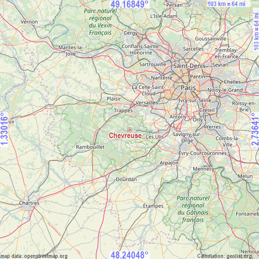
Chevreuse GPS coordinates[2]
48° 42' 23.832" North, 2° 1' 59.844" East
| Map corner | latitude | longitude |
|---|---|---|
| Upper-left | 49.16849°, | 1.33016° |
| Center: | 48.70662°, | 2.03329° |
| Lower-right: | 48.24048°, | 2.73641° |
| Map W x H: | 103.2×103.2 km | = 64.1×64.1mi |
| max Lat: | 51.07786° ⇑26.6% North |
| Chevreuse: | 48.70662° |
| min Lat: | ⇓73.4% South 41.3874° |
| min Long | Chevreuse | max Long |
| -5.08615° | 2.03329° | 9.52242° |
| W 43.3%⇐ | ⇒56.7% E |
Elevation
Elevation of Chevreuse is 92 m = 302 ft, and this is 101.7 m = 334 ft below average elevation for this country.
| Max E: |
2333 m = 7654 ft | 64% |
| Avg. | 193.7 m = 635 ft | |
| Chevreuse | 92 m = 302 ft | |
Min E: |
-1 m = -3 ft | 36% |
See also: France elevation on elevation.city.
Geographical zone
Chevreuse is located in North temperate zone (between Tropic of Cancer and the Arctic Circle). Distance of this North polar circle is 1985.5 km =1233.7 mi to North.| Distance of | km | miles | from Chevreuse |
|---|---|---|---|
| North Pole | 4591.4 | 2853 | to North |
| Arctic Circle | 1985.5 | 1233.7 | to North |
| Tropic Cancer | 2809.7 | 1745.9 | to South |
| Equator | 5415.7 | 3365.2 | to South |


Nearby cities:
15 places around Chevreuse: (largest is in red/bold)
• Boullay-les-Troux
3.3 km =2.1 mi,  159°
159°
• Cernay-la-Ville
5.7 km =3.5 mi,  229°
229°
• Choisel
2.4 km =1.5 mi,  207°
207°
• Châteaufort
5.3 km =3.3 mi,  52°
52°
• Dampierre-en-Yvelines
3.7 km =2.3 mi,  258°
258°
• Les Molières
4.6 km =2.9 mi,  144°
144°
• Lévis-Saint-Nom
6.2 km =3.9 mi,  280°
280°
• Magny-les-Hameaux
4.6 km =2.9 mi,  26°
26°
• Montigny-le-Bretonneux
6.6 km =4.1 mi,  0°
0°
• Pecqueuse
6.7 km =4.2 mi,  170°
170°
• Saint-Forget
2.6 km =1.6 mi,  253°
253°
• Saint-Rémy-lès-Chevreuse
3.2 km =2 mi,  89°
89°
• Senlisse
4.3 km =2.7 mi,  241°
241°
• Villiers-le-Bâcle
6.7 km =4.2 mi,  69°
69°
• Voisins-le-Bretonneux
5.9 km =3.7 mi,  13°
13°
Sources, notices
• [Note1] Compared only with cities in France existing in our database
• [Src1] Map data: © OpenStreetMap contributors (CC-BY-SA)
• [Src2] Other city data from geonames.org with taken over terms of usage.
• [Src3] Geographical zone / Annual Mean Temperature by Robert A. Rohde @ Wikipedia
