Boullay-les-Troux geodata
Boullay-les-Troux (Île-de-France) is a populated place; located in France in Europe/Paris (GMT+2) time zone. With population of 612 people, there are 13126 cities with bigger population in this country. Compared to other cities in France, 72.7% of cities are located further ↓South; 56.5% of cities are located further →East and 60.5% of cities have lower elevation than Boullay-les-Troux. Note1
Administrative division(s):
- Level 1: Île-de-France
- Level 2: Département de l'Essonne
- Level 3: Arrondissement de Palaiseau
- Level 4: Boullay-les-Troux


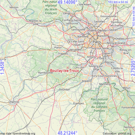
Boullay-les-Troux GPS coordinates[2]
48° 40' 43.824" North, 2° 2' 56.112" East
| Map corner | latitude | longitude |
|---|---|---|
| Upper-left | 49.14096°, | 1.3458° |
| Center: | 48.67884°, | 2.04892° |
| Lower-right: | 48.21244°, | 2.75205° |
| Map W x H: | 103.2×103.2 km | = 64.1×64.1mi |
| max Lat: | 51.07786° ⇑27.3% North |
| Boullay-les-Troux: | 48.67884° |
| min Lat: | ⇓72.7% South 41.3874° |
| min Long | Boullay-les-Tro | max Long |
| -5.08615° | 2.04892° | 9.52242° |
| W 43.5%⇐ | ⇒56.5% E |
Elevation
Elevation of Boullay-les-Troux is 172 m = 564 ft, and this is 21.7 m = 71 ft below average elevation for this country.
| Max E: |
2333 m = 7654 ft | 39.5% |
| Avg. | 193.7 m = 635 ft | |
| Boullay-les-Troux | 172 m = 564 ft | |
Min E: |
-1 m = -3 ft | 60.5% |
See also: France elevation on elevation.city.
Geographical zone
Boullay-les-Troux is located in North temperate zone (between Tropic of Cancer and the Arctic Circle). Distance of this North polar circle is 1988.6 km =1235.7 mi to North.| Distance of | km | miles | from Boullay-les-Troux |
|---|---|---|---|
| North Pole | 4594.5 | 2854.9 | to North |
| Arctic Circle | 1988.6 | 1235.7 | to North |
| Tropic Cancer | 2806.7 | 1744 | to South |
| Equator | 5412.6 | 3363.2 | to South |


Nearby cities:
15 places around Boullay-les-Troux: (largest is in red/bold)
• Bonnelles
6.9 km =4.3 mi,  192°
192°
• Cernay-la-Ville
5.5 km =3.4 mi,  263°
263°
• Chevreuse
3.3 km =2.1 mi,  339°
339°
• Choisel
2.5 km =1.6 mi,  293°
293°
• Dampierre-en-Yvelines
5.4 km =3.4 mi,  296°
296°
• Forges-les-Bains
6.8 km =4.2 mi,  144°
144°
• Gif-sur-Yvette
6.2 km =3.9 mi,  85°
85°
• Gometz-la-Ville
5.9 km =3.7 mi,  97°
97°
• Gometz-le-Châtel
6.5 km =4 mi, 90°
• Les Molières
1.6 km =1 mi,  112°
112°
• Limours
4.2 km =2.6 mi,  150°
150°
• Pecqueuse
3.6 km =2.2 mi,  181°
181°
• Saint-Forget
4.3 km =2.7 mi, 303°
• Saint-Rémy-lès-Chevreuse
3.8 km =2.4 mi,  33°
33°
• Senlisse
5 km =3.1 mi,  282°
282°
Sources, notices
• [Note1] Compared only with cities in France existing in our database
• [Src1] Map data: © OpenStreetMap contributors (CC-BY-SA)
• [Src2] Other city data from geonames.org with taken over terms of usage.
• [Src3] Geographical zone / Annual Mean Temperature by Robert A. Rohde @ Wikipedia
