Chaveignes geodata
Chaveignes (Centre) is a populated place; located in France in Europe/Paris (GMT+2) time zone. With population of 553 people, there are 14157 cities with bigger population in this country. Compared to other cities in France, 54.9% of cities are located further ↑North; 74.8% of cities are located further →East and 82.6% of cities have higher elevation than Chaveignes. Note1
Administrative division(s):
- Level 1: Centre
- Level 2: Département d'Indre-et-Loire
- Level 3: Arrondissement de Chinon
- Level 4: Chaveignes


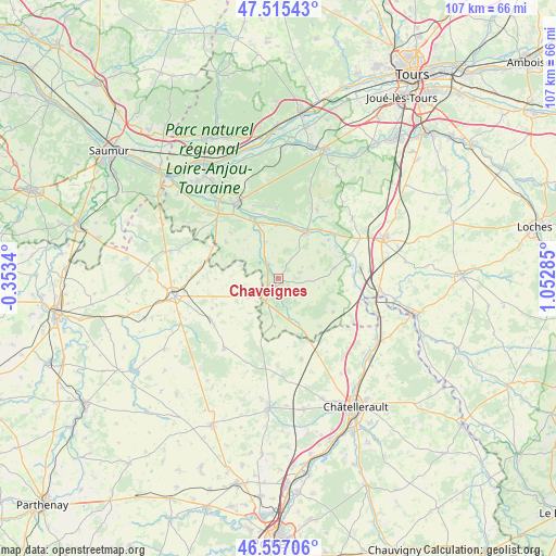
Chaveignes GPS coordinates[2]
47° 2' 18.24" North, 0° 20' 59.028" East
| Map corner | latitude | longitude |
|---|---|---|
| Upper-left | 47.51543°, | -0.3534° |
| Center: | 47.0384°, | 0.34973° |
| Lower-right: | 46.55706°, | 1.05285° |
| Map W x H: | 106.6×106.6 km | = 66.2×66.2mi |
| max Lat: | 51.07786° ⇑54.9% North |
| Chaveignes: | 47.0384° |
| min Lat: | ⇓45.1% South 41.3874° |
| min Long | Chaveignes | max Long |
| -5.08615° | 0.34973° | 9.52242° |
| W 25.2%⇐ | ⇒74.8% E |
Elevation
Elevation of Chaveignes is 48 m = 157 ft, and this is 145.7 m = 478 ft below average elevation for this country.
| Max E: |
2333 m = 7654 ft | 82.6% |
| Avg. | 193.7 m = 635 ft | |
| Chaveignes | 48 m = 157 ft | |
Min E: |
-1 m = -3 ft | 17.4% |
See also: France elevation on elevation.city.
Geographical zone
Chaveignes is located in North temperate zone (between Tropic of Cancer and the Arctic Circle). Distance of this North polar circle is 2171 km =1349 mi to North.| Distance of | km | miles | from Chaveignes |
|---|---|---|---|
| North Pole | 4776.9 | 2968.2 | to North |
| Arctic Circle | 2171 | 1349 | to North |
| Tropic Cancer | 2624.3 | 1630.7 | to South |
| Equator | 5230.2 | 3249.9 | to South |


Nearby cities:
15 places around Chaveignes: (largest is in red/bold)
• Beuxes
14.3 km =8.9 mi,  295°
295°
• Ceaux-en-Loudun
8.5 km =5.3 mi,  260°
260°
• Champigny-sur-Veude
3.4 km =2.1 mi,  331°
331°
• Cravant-les-Coteaux
13.3 km =8.3 mi,  358°
358°
• Crouzilles
12.6 km =7.8 mi,  41°
41°
• L'Île-Bouchard
10.1 km =6.3 mi,  30°
30°
• La Tour-Saint-Gelin
4.2 km =2.6 mi,  73°
73°
• Ligré
9.9 km =6.2 mi, 325°
• Marcilly-sur-Vienne
14.4 km =8.9 mi,  87°
87°
• Marigny-Marmande
12.3 km =7.6 mi,  120°
120°
• Panzoult
12.6 km =7.8 mi,  18°
18°
• Parçay-sur-Vienne
12.2 km =7.6 mi,  52°
52°
• Pouant
7 km =4.3 mi,  238°
238°
• Richelieu
3.3 km =2.1 mi,  215°
215°
• Rivière
13.1 km =8.1 mi,  335°
335°
Sources, notices
• [Note1] Compared only with cities in France existing in our database
• [Src1] Map data: © OpenStreetMap contributors (CC-BY-SA)
• [Src2] Other city data from geonames.org with taken over terms of usage.
• [Src3] Geographical zone / Annual Mean Temperature by Robert A. Rohde @ Wikipedia
