Chaudenay geodata
Chaudenay (Bourgogne-Franche-Comté) is a populated place; located in France in Europe/Paris (GMT+2) time zone. With population of 847 people, there are 10113 cities with bigger population in this country. Compared to other cities in France, 56.1% of cities are located further ↑North; 74.9% of cities are located further ←West and 66.2% of cities have lower elevation than Chaudenay. Note1
Administrative division(s):
- Level 1: Bourgogne-Franche-Comté
- Level 2: Département de Saône-et-Loire
- Level 3: Arrondissement de Chalon-sur-Saône
- Level 4: Chaudenay


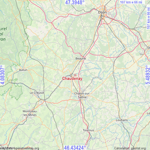
Chaudenay GPS coordinates[2]
46° 55' 0.012" North, 4° 47' 10.284" East
| Map corner | latitude | longitude |
|---|---|---|
| Upper-left | 47.3948°, | 4.08307° |
| Center: | 46.91667°, | 4.78619° |
| Lower-right: | 46.43424°, | 5.48932° |
| Map W x H: | 106.8×106.8 km | = 66.4×66.4mi |
| max Lat: | 51.07786° ⇑56.1% North |
| Chaudenay: | 46.91667° |
| min Lat: | ⇓43.9% South 41.3874° |
| min Long | Chaudenay | max Long |
| -5.08615° | 4.78619° | 9.52242° |
| W 74.9%⇐ | ⇒25.1% E |
Elevation
Elevation of Chaudenay is 200 m = 656 ft, and this is 6.3 m = 21 ft above average elevation for this country.
| Max E: |
2333 m = 7654 ft | 33.8% |
| Chaudenay | 200 m 656 ft | |
| Avg. | 193.7 m = 635 ft | |
Min E: |
-1 m = -3 ft | 66.2% |
See also: France elevation on elevation.city.
Geographical zone
Chaudenay is located in North temperate zone (between Tropic of Cancer and the Arctic Circle). Distance of this North polar circle is 2184.5 km =1357.4 mi to North.| Distance of | km | miles | from Chaudenay |
|---|---|---|---|
| North Pole | 4790.4 | 2976.6 | to North |
| Arctic Circle | 2184.5 | 1357.4 | to North |
| Tropic Cancer | 2610.7 | 1622.2 | to South |
| Equator | 5216.6 | 3241.4 | to South |


Nearby cities:
15 places around Chaudenay: (largest is in red/bold)
• Bligny-lès-Beaune
8.3 km =5.2 mi,  21°
21°
• Chagny
2.7 km =1.7 mi,  253°
253°
• Corpeau
2.9 km =1.8 mi,  298°
298°
• Demigny
3.9 km =2.4 mi,  66°
66°
• Farges-lès-Chalon
9.3 km =5.8 mi,  169°
169°
• Fontaines
7.6 km =4.7 mi,  189°
189°
• Fragnes
10 km =6.2 mi,  153°
153°
• Lessard-le-National
6.8 km =4.2 mi, 145°
• Merceuil
5.6 km =3.5 mi,  49°
49°
• Mercurey
10 km =6.2 mi,  211°
211°
• Meursault
7 km =4.3 mi,  349°
349°
• Montagny-lès-Beaune
9.6 km =6 mi,  30°
30°
• Rully
5.7 km =3.5 mi,  215°
215°
• Saint-Loup-Géanges
9.4 km =5.8 mi, 66°
• Santenay
6.8 km =4.2 mi,  266°
266°
Sources, notices
• [Note1] Compared only with cities in France existing in our database
• [Src1] Map data: © OpenStreetMap contributors (CC-BY-SA)
• [Src2] Other city data from geonames.org with taken over terms of usage.
• [Src3] Geographical zone / Annual Mean Temperature by Robert A. Rohde @ Wikipedia
