Châtillon-sur-Seiche geodata
Châtillon-sur-Seiche (Brittany) is a populated place; located in France in Europe/Paris (GMT+2) time zone. With population of 6,152 people, there are 1611 cities with bigger population in this country. Compared to other cities in France, 59.9% of cities are located further ↓South; 93.4% of cities are located further →East and 92.7% of cities have higher elevation than Châtillon-sur-Seiche. Note1
Administrative division(s):
- Level 1: Brittany
- Level 2: Département d'Ille-et-Vilaine
- Level 3: Arrondissement de Rennes
- Level 4: Noyal-Châtillon-sur-Seiche
Current local time in Châtillon-sur-Seiche:
06:08 AM, WednesdayDifference from your time zone: hours


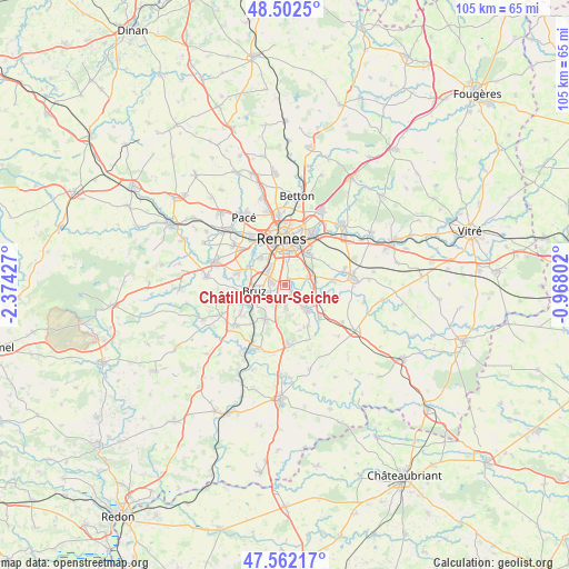
Châtillon-sur-Seiche GPS coordinates[2]
48° 2' 4.128" North, 1° 40' 16.104" West
| Map corner | latitude | longitude |
|---|---|---|
| Upper-left | 48.5025°, | -2.37427° |
| Center: | 48.03448°, | -1.67114° |
| Lower-right: | 47.56217°, | -0.96802° |
| Map W x H: | 104.6×104.6 km | = 65×65mi |
| max Lat: | 51.07786° ⇑40.1% North |
| Châtillon-sur-Seiche: | 48.03448° |
| min Lat: | ⇓59.9% South 41.3874° |
| min Long | Châtillon-sur- | max Long |
| -5.08615° | -1.67114° | 9.52242° |
| W 6.6%⇐ | ⇒93.4% E |
Elevation
Elevation of Châtillon-sur-Seiche is 23 m = 75 ft, and this is 170.7 m = 560 ft below average elevation for this country.
| Max E: |
2333 m = 7654 ft | 92.7% |
| Avg. | 193.7 m = 635 ft | |
| Châtillon-sur-Seiche | 23 m = 75 ft | |
Min E: |
-1 m = -3 ft | 7.3% |
See also: France elevation on elevation.city.
Geographical zone
Châtillon-sur-Seiche is located in North temperate zone (between Tropic of Cancer and the Arctic Circle). Distance of this North polar circle is 2060.2 km =1280.1 mi to North.| Distance of | km | miles | from Châtillon-sur-Seiche |
|---|---|---|---|
| North Pole | 4666.1 | 2899.4 | to North |
| Arctic Circle | 2060.2 | 1280.1 | to North |
| Tropic Cancer | 2735 | 1699.4 | to South |
| Equator | 5340.9 | 3318.7 | to South |


Nearby cities:
15 places around Châtillon-sur-Seiche: (largest is in red/bold)
• Bourgbarré
6.1 km =3.8 mi,  135°
135°
• Bruz
5.7 km =3.5 mi,  258°
258°
• Chanteloup
8.7 km =5.4 mi,  151°
151°
• Chantepie
7.3 km =4.5 mi,  34°
34°
• Chartres-de-Bretagne
2.6 km =1.6 mi,  281°
281°
• Chavagne
8.8 km =5.5 mi, 284°
• Corps-Nuds
8.9 km =5.5 mi,  133°
133°
• Laillé
7.1 km =4.4 mi,  208°
208°
• Nouvoitou
9.2 km =5.7 mi,  85°
85°
• Orgères
4 km =2.5 mi,  176°
176°
• Rennes
8.6 km =5.3 mi,  358°
358°
• Saint-Armel
6.4 km =4 mi,  111°
111°
• Saint-Erblon
2.3 km =1.4 mi, 139°
• Saint-Jacques-de-la-Lande
5 km =3.1 mi,  312°
312°
• Vern-sur-Seiche
5.4 km =3.4 mi,  77°
77°
Sources, notices
• [Note1] Compared only with cities in France existing in our database
• [Src1] Map data: © OpenStreetMap contributors (CC-BY-SA)
• [Src2] Other city data from geonames.org with taken over terms of usage.
• [Src3] Geographical zone / Annual Mean Temperature by Robert A. Rohde @ Wikipedia
