Château-d’Olonne geodata
Château-d’Olonne (Pays de la Loire) is a populated place; located in France in Europe/Paris (GMT+2) time zone. With population of 13,420 people, there are 712 cities with bigger population in this country. Compared to other cities in France, 60.1% of cities are located further ↑North; 93.7% of cities are located further →East and 92% of cities have higher elevation than Château-d’Olonne. Note1
Administrative division(s):
- Level 1: Pays de la Loire
- Level 2: Département de la Vendée
- Level 3: Arrondissement des Sables-d'Olonne
- Level 4: Les Sables-d'Olonne


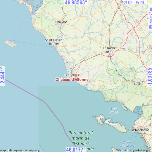
Château-d’Olonne GPS coordinates[2]
46° 30' 13.752" North, 1° 44' 27.492" West
| Map corner | latitude | longitude |
|---|---|---|
| Upper-left | 46.98563°, | -2.4441° |
| Center: | 46.50382°, | -1.74097° |
| Lower-right: | 46.0177°, | -1.03785° |
| Map W x H: | 107.6×107.6 km | = 66.9×66.9mi |
| max Lat: | 51.07786° ⇑60.1% North |
| Château-d’Olonne: | 46.50382° |
| min Lat: | ⇓39.9% South 41.3874° |
| min Long | Château-d’Ol | max Long |
| -5.08615° | -1.74097° | 9.52242° |
| W 6.3%⇐ | ⇒93.7% E |
Elevation
Elevation of Château-d’Olonne is 25 m = 82 ft, and this is 168.7 m = 553 ft below average elevation for this country.
| Max E: |
2333 m = 7654 ft | 92% |
| Avg. | 193.7 m = 635 ft | |
| Château-d’Olonne | 25 m = 82 ft | |
Min E: |
-1 m = -3 ft | 8% |
See also: France elevation on elevation.city.
Geographical zone
Château-d’Olonne is located in North temperate zone (between Tropic of Cancer and the Arctic Circle). Distance of this North polar circle is 2230.4 km =1385.9 mi to North.| Distance of | km | miles | from Château-d’Olonne |
|---|---|---|---|
| North Pole | 4836.3 | 3005.1 | to North |
| Arctic Circle | 2230.4 | 1385.9 | to North |
| Tropic Cancer | 2564.8 | 1593.7 | to South |
| Equator | 5170.7 | 3212.9 | to South |


Nearby cities:
15 places around Château-d’Olonne: (largest is in red/bold)
• Grosbreuil
10.3 km =6.4 mi,  67°
67°
• Jard-sur-Mer
16 km =9.9 mi,  128°
128°
• La Chaize-Giraud
16.9 km =10.5 mi,  339°
339°
• La Chapelle-Achard
11.8 km =7.3 mi,  37°
37°
• La Mothe-Achard
13.9 km =8.6 mi,  26°
26°
• Landevieille
16.1 km =10 mi, 341°
• Le Girouard
13 km =8.1 mi,  56°
56°
• Les Sables-d’Olonne
3.4 km =2.1 mi,  256°
256°
• Olonne-sur-Mer
4.3 km =2.7 mi,  325°
325°
• Saint-Hilaire-de-Talmont
11.2 km =7 mi,  109°
109°
• Saint-Julien-des-Landes
15.2 km =9.4 mi,  7°
7°
• Saint-Mathurin
7.1 km =4.4 mi,  16°
16°
• Saint-Vincent-sur-Jard
17 km =10.6 mi,  124°
124°
• Sainte-Foy
6.9 km =4.3 mi,  48°
48°
• Vairé
10.9 km =6.8 mi,  354°
354°
Sources, notices
• [Note1] Compared only with cities in France existing in our database
• [Src1] Map data: © OpenStreetMap contributors (CC-BY-SA)
• [Src2] Other city data from geonames.org with taken over terms of usage.
• [Src3] Geographical zone / Annual Mean Temperature by Robert A. Rohde @ Wikipedia
