Changy geodata
Changy (Auvergne-Rhône-Alpes) is a populated place; located in France in Europe/Paris (GMT+2) time zone. With population of 594 people, there are 13430 cities with bigger population in this country. Compared to other cities in France, 64.4% of cities are located further ↑North; 66.9% of cities are located further ←West and 86.1% of cities have lower elevation than Changy. Note1
Administrative division(s):
- Level 1: Auvergne-Rhône-Alpes
- Level 2: Département de la Loire
- Level 3: Arrondissement de Roanne
- Level 4: Changy


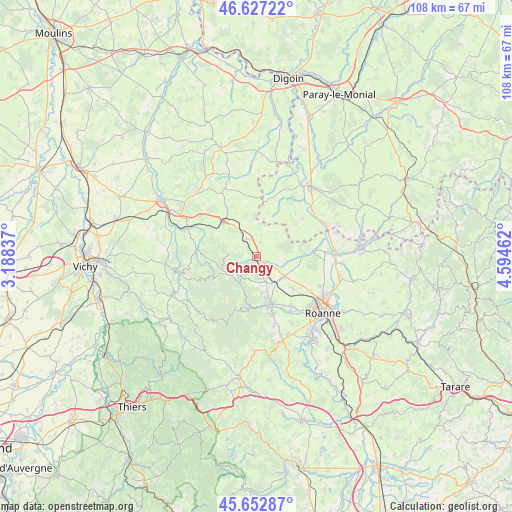
Changy GPS coordinates[2]
46° 8' 31.92" North, 3° 53' 29.364" East
| Map corner | latitude | longitude |
|---|---|---|
| Upper-left | 46.62722°, | 3.18837° |
| Center: | 46.1422°, | 3.89149° |
| Lower-right: | 45.65287°, | 4.59462° |
| Map W x H: | 108.3×108.3 km | = 67.3×67.3mi |
| max Lat: | 51.07786° ⇑64.4% North |
| Changy: | 46.1422° |
| min Lat: | ⇓35.6% South 41.3874° |
| min Long | Changy | max Long |
| -5.08615° | 3.89149° | 9.52242° |
| W 66.9%⇐ | ⇒33.1% E |
Elevation
Elevation of Changy is 361 m = 1184 ft, and this is 167.3 m = 549 ft above average elevation for this country.
| Max E: |
2333 m = 7654 ft | 13.9% |
| Changy | 361 m 1184 ft | |
| Avg. | 193.7 m = 635 ft | |
Min E: |
-1 m = -3 ft | 86.1% |
See also: France elevation on elevation.city.
Geographical zone
Changy is located in North temperate zone (between Tropic of Cancer and the Arctic Circle). Distance of this North polar circle is 2270.6 km =1410.9 mi to North.| Distance of | km | miles | from Changy |
|---|---|---|---|
| North Pole | 4876.5 | 3030.1 | to North |
| Arctic Circle | 2270.6 | 1410.9 | to North |
| Tropic Cancer | 2524.6 | 1568.7 | to South |
| Equator | 5130.5 | 3187.9 | to South |


Nearby cities:
15 places around Changy: (largest is in red/bold)
• Ambierle
4.1 km =2.5 mi,  178°
178°
• Arfeuilles
12.7 km =7.9 mi,  276°
276°
• Briennon
14.3 km =8.9 mi,  85°
85°
• La Pacaudière
4.6 km =2.9 mi,  331°
331°
• Melay
13.7 km =8.5 mi,  52°
52°
• Noailly
9.4 km =5.8 mi, 94°
• Pouilly-les-Nonains
12.9 km =8 mi,  146°
146°
• Renaison
10.6 km =6.6 mi,  166°
166°
• Saint-Alban-les-Eaux
15.2 km =9.4 mi,  163°
163°
• Saint-Germain-Lespinasse
7.1 km =4.4 mi,  127°
127°
• Saint-Haon-le-Châtel
8.9 km =5.5 mi, 166°
• Saint-Haon-le-Vieux
7.6 km =4.7 mi, 171°
• Saint-Léger-sur-Roanne
13.8 km =8.6 mi,  144°
144°
• Saint-Martin-d’Estréaux
9.8 km =6.1 mi,  313°
313°
• Saint-Romain-la-Motte
10.2 km =6.3 mi, 131°
Sources, notices
• [Note1] Compared only with cities in France existing in our database
• [Src1] Map data: © OpenStreetMap contributors (CC-BY-SA)
• [Src2] Other city data from geonames.org with taken over terms of usage.
• [Src3] Geographical zone / Annual Mean Temperature by Robert A. Rohde @ Wikipedia
