Noailly geodata
Noailly (Auvergne-Rhône-Alpes) is a populated place; located in France in Europe/Paris (GMT+2) time zone. With population of 732 people, there are 11386 cities with bigger population in this country. Compared to other cities in France, 64.5% of cities are located further ↑North; 67.9% of cities are located further ←West and 81.6% of cities have lower elevation than Noailly. Note1
Administrative division(s):
- Level 1: Auvergne-Rhône-Alpes
- Level 2: Département de la Loire
- Level 3: Arrondissement de Roanne
- Level 4: Noailly


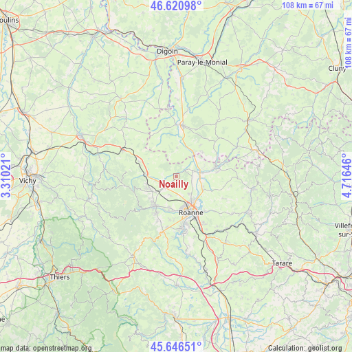
Noailly GPS coordinates[2]
46° 8' 9.24" North, 4° 0' 48.024" East
| Map corner | latitude | longitude |
|---|---|---|
| Upper-left | 46.62098°, | 3.31021° |
| Center: | 46.1359°, | 4.01334° |
| Lower-right: | 45.64651°, | 4.71646° |
| Map W x H: | 108.4×108.3 km | = 67.4×67.3mi |
| max Lat: | 51.07786° ⇑64.5% North |
| Noailly: | 46.1359° |
| min Lat: | ⇓35.5% South 41.3874° |
| min Long | Noailly | max Long |
| -5.08615° | 4.01334° | 9.52242° |
| W 67.9%⇐ | ⇒32.1% E |
Elevation
Elevation of Noailly is 306 m = 1004 ft, and this is 112.3 m = 368 ft above average elevation for this country.
| Max E: |
2333 m = 7654 ft | 18.4% |
| Noailly | 306 m 1004 ft | |
| Avg. | 193.7 m = 635 ft | |
Min E: |
-1 m = -3 ft | 81.6% |
See also: France elevation on elevation.city.
Geographical zone
Noailly is located in North temperate zone (between Tropic of Cancer and the Arctic Circle). Distance of this North polar circle is 2271.3 km =1411.3 mi to North.| Distance of | km | miles | from Noailly |
|---|---|---|---|
| North Pole | 4877.2 | 3030.6 | to North |
| Arctic Circle | 2271.3 | 1411.3 | to North |
| Tropic Cancer | 2523.9 | 1568.3 | to South |
| Equator | 5129.8 | 3187.5 | to South |


Nearby cities:
15 places around Noailly: (largest is in red/bold)
• Ambierle
9.9 km =6.2 mi,  249°
249°
• Briennon
5.2 km =3.2 mi,  70°
70°
• Changy
9.4 km =5.8 mi,  274°
274°
• Iguerande
9.1 km =5.7 mi,  35°
35°
• Mably
8.7 km =5.4 mi,  155°
155°
• Melay
9.1 km =5.7 mi,  9°
9°
• Pouilly-les-Nonains
10.4 km =6.5 mi,  193°
193°
• Pouilly-sous-Charlieu
7.7 km =4.8 mi,  82°
82°
• Riorges
10.5 km =6.5 mi,  167°
167°
• Saint-Germain-Lespinasse
5.2 km =3.2 mi,  225°
225°
• Saint-Haon-le-Vieux
10.7 km =6.6 mi, 230°
• Saint-Léger-sur-Roanne
10.6 km =6.6 mi, 187°
• Saint-Nizier-sous-Charlieu
8.7 km =5.4 mi, 77°
• Saint-Romain-la-Motte
6.3 km =3.9 mi,  196°
196°
• Vougy
8.8 km =5.5 mi,  113°
113°
Sources, notices
• [Note1] Compared only with cities in France existing in our database
• [Src1] Map data: © OpenStreetMap contributors (CC-BY-SA)
• [Src2] Other city data from geonames.org with taken over terms of usage.
• [Src3] Geographical zone / Annual Mean Temperature by Robert A. Rohde @ Wikipedia
