Renaison geodata
Renaison (Auvergne-Rhône-Alpes) is a populated place; located in France in Europe/Paris (GMT+2) time zone. With population of 2,828 people, there are 3448 cities with bigger population in this country. Compared to other cities in France, 65.7% of cities are located further ↑North; 67.2% of cities are located further ←West and 86.7% of cities have lower elevation than Renaison. Note1
Administrative division(s):
- Level 1: Auvergne-Rhône-Alpes
- Level 2: Département de la Loire
- Level 3: Arrondissement de Roanne
- Level 4: Renaison


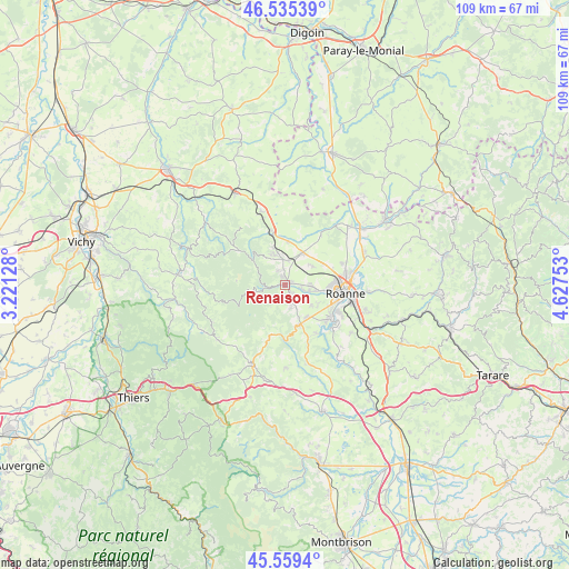
Renaison GPS coordinates[2]
46° 2' 58.38" North, 3° 55' 27.84" East
| Map corner | latitude | longitude |
|---|---|---|
| Upper-left | 46.53539°, | 3.22128° |
| Center: | 46.04955°, | 3.9244° |
| Lower-right: | 45.5594°, | 4.62753° |
| Map W x H: | 108.5×108.5 km | = 67.4×67.4mi |
| max Lat: | 51.07786° ⇑65.7% North |
| Renaison: | 46.04955° |
| min Lat: | ⇓34.3% South 41.3874° |
| min Long | Renaison | max Long |
| -5.08615° | 3.9244° | 9.52242° |
| W 67.2%⇐ | ⇒32.8% E |
Elevation
Elevation of Renaison is 370 m = 1214 ft, and this is 176.3 m = 578 ft above average elevation for this country.
| Max E: |
2333 m = 7654 ft | 13.3% |
| Renaison | 370 m 1214 ft | |
| Avg. | 193.7 m = 635 ft | |
Min E: |
-1 m = -3 ft | 86.7% |
See also: France elevation on elevation.city.
Geographical zone
Renaison is located in North temperate zone (between Tropic of Cancer and the Arctic Circle). Distance of this North polar circle is 2280.9 km =1417.3 mi to North.| Distance of | km | miles | from Renaison |
|---|---|---|---|
| North Pole | 4886.8 | 3036.5 | to North |
| Arctic Circle | 2280.9 | 1417.3 | to North |
| Tropic Cancer | 2514.3 | 1562.3 | to South |
| Equator | 5120.2 | 3181.5 | to South |


Nearby cities:
15 places around Renaison: (largest is in red/bold)
• Ambierle
6.7 km =4.2 mi,  338°
338°
• Changy
10.6 km =6.6 mi,  346°
346°
• Lentigny
7.5 km =4.7 mi,  145°
145°
• Mably
10.6 km =6.6 mi,  80°
80°
• Ouches
6.2 km =3.9 mi,  127°
127°
• Pouilly-les-Nonains
4.5 km =2.8 mi,  96°
96°
• Riorges
9.1 km =5.7 mi,  94°
94°
• Saint-Alban-les-Eaux
4.6 km =2.9 mi,  157°
157°
• Saint-Germain-Lespinasse
6.8 km =4.2 mi,  27°
27°
• Saint-Haon-le-Châtel
1.7 km =1.1 mi, 341°
• Saint-Haon-le-Vieux
3.1 km =1.9 mi,  332°
332°
• Saint-Léger-sur-Roanne
5.6 km =3.5 mi, 98°
• Saint-Romain-la-Motte
6.2 km =3.9 mi,  55°
55°
• Villemontais
8 km =5 mi, 162°
• Villerest
10.4 km =6.5 mi, 125°
Sources, notices
• [Note1] Compared only with cities in France existing in our database
• [Src1] Map data: © OpenStreetMap contributors (CC-BY-SA)
• [Src2] Other city data from geonames.org with taken over terms of usage.
• [Src3] Geographical zone / Annual Mean Temperature by Robert A. Rohde @ Wikipedia
