Melay geodata
Melay (Bourgogne-Franche-Comté) is a populated place; located in France in Europe/Paris (GMT+2) time zone. With population of 832 people, there are 10268 cities with bigger population in this country. Compared to other cities in France, 63.3% of cities are located further ↑North; 68.1% of cities are located further ←West and 74.9% of cities have lower elevation than Melay. Note1
Administrative division(s):
- Level 1: Bourgogne-Franche-Comté
- Level 2: Département de Saône-et-Loire
- Level 3: Arrondissement de Charolles
- Level 4: Melay


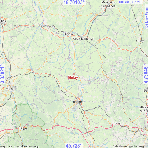
Melay GPS coordinates[2]
46° 13' 0.012" North, 4° 1' 59.988" East
| Map corner | latitude | longitude |
|---|---|---|
| Upper-left | 46.70103°, | 3.33021° |
| Center: | 46.21667°, | 4.03333° |
| Lower-right: | 45.728°, | 4.73646° |
| Map W x H: | 108.2×108.2 km | = 67.2×67.2mi |
| max Lat: | 51.07786° ⇑63.3% North |
| Melay: | 46.21667° |
| min Lat: | ⇓36.7% South 41.3874° |
| min Long | Melay | max Long |
| -5.08615° | 4.03333° | 9.52242° |
| W 68.1%⇐ | ⇒31.9% E |
Elevation
Elevation of Melay is 248 m = 814 ft, and this is 54.3 m = 178 ft above average elevation for this country.
| Max E: |
2333 m = 7654 ft | 25.1% |
| Melay | 248 m 814 ft | |
| Avg. | 193.7 m = 635 ft | |
Min E: |
-1 m = -3 ft | 74.9% |
See also: France elevation on elevation.city.
Geographical zone
Melay is located in North temperate zone (between Tropic of Cancer and the Arctic Circle). Distance of this North polar circle is 2262.4 km =1405.8 mi to North.| Distance of | km | miles | from Melay |
|---|---|---|---|
| North Pole | 4868.2 | 3025 | to North |
| Arctic Circle | 2262.4 | 1405.8 | to North |
| Tropic Cancer | 2532.9 | 1573.9 | to South |
| Equator | 5138.8 | 3193.1 | to South |


Nearby cities:
15 places around Melay: (largest is in red/bold)
• Briennon
8 km =5 mi,  155°
155°
• Changy
13.7 km =8.5 mi,  232°
232°
• Charlieu
12.3 km =7.6 mi,  119°
119°
• Fleury-la-Montagne
6.7 km =4.2 mi,  101°
101°
• Iguerande
4 km =2.5 mi,  112°
112°
• La Pacaudière
13.8 km =8.6 mi,  252°
252°
• Marcigny
6.6 km =4.1 mi,  4°
4°
• Noailly
9.1 km =5.7 mi,  189°
189°
• Pouilly-sous-Charlieu
10 km =6.2 mi,  142°
142°
• Saint-Christophe-en-Brionnais
13.7 km =8.5 mi,  54°
54°
• Saint-Denis-de-Cabanne
14.8 km =9.2 mi, 109°
• Saint-Germain-Lespinasse
13.6 km =8.5 mi,  202°
202°
• Saint-Nizier-sous-Charlieu
9.9 km =6.2 mi, 135°
• Semur-en-Brionnais
7.3 km =4.5 mi,  40°
40°
• Vougy
14.1 km =8.8 mi,  152°
152°
Sources, notices
• [Note1] Compared only with cities in France existing in our database
• [Src1] Map data: © OpenStreetMap contributors (CC-BY-SA)
• [Src2] Other city data from geonames.org with taken over terms of usage.
• [Src3] Geographical zone / Annual Mean Temperature by Robert A. Rohde @ Wikipedia
