Chancenay geodata
Chancenay (Grand Est) is a populated place; located in France in Europe/Paris (GMT+2) time zone. With population of 1,131 people, there are 7936 cities with bigger population in this country. Compared to other cities in France, 72.5% of cities are located further ↓South; 77.5% of cities are located further ←West and 62.4% of cities have lower elevation than Chancenay. Note1
Administrative division(s):
- Level 1: Grand Est
- Level 2: Haute-Marne
- Level 3: Arrondissement de Saint-Dizier
- Level 4: Chancenay


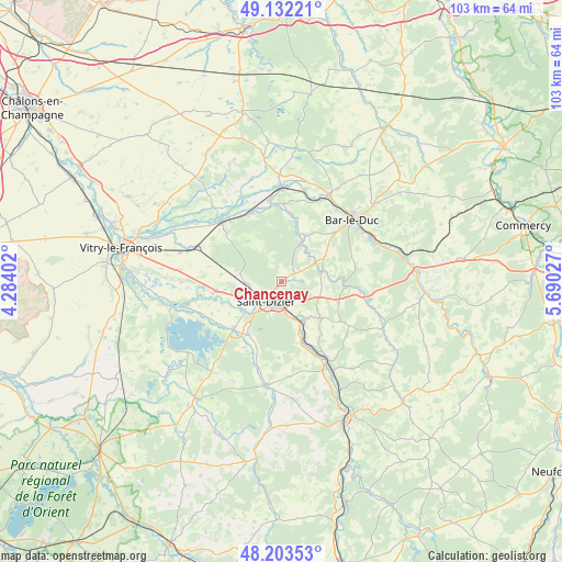
Chancenay GPS coordinates[2]
48° 40' 12.036" North, 4° 59' 13.74" East
| Map corner | latitude | longitude |
|---|---|---|
| Upper-left | 49.13221°, | 4.28402° |
| Center: | 48.67001°, | 4.98715° |
| Lower-right: | 48.20353°, | 5.69027° |
| Map W x H: | 103.3×103.3 km | = 64.2×64.2mi |
| max Lat: | 51.07786° ⇑27.5% North |
| Chancenay: | 48.67001° |
| min Lat: | ⇓72.5% South 41.3874° |
| min Long | Chancenay | max Long |
| -5.08615° | 4.98715° | 9.52242° |
| W 77.5%⇐ | ⇒22.5% E |
Elevation
Elevation of Chancenay is 181 m = 594 ft, and this is 12.7 m = 42 ft below average elevation for this country.
| Max E: |
2333 m = 7654 ft | 37.6% |
| Avg. | 193.7 m = 635 ft | |
| Chancenay | 181 m = 594 ft | |
Min E: |
-1 m = -3 ft | 62.4% |
See also: France elevation on elevation.city.
Geographical zone
Chancenay is located in North temperate zone (between Tropic of Cancer and the Arctic Circle). Distance of this North polar circle is 1989.6 km =1236.3 mi to North.| Distance of | km | miles | from Chancenay |
|---|---|---|---|
| North Pole | 4595.5 | 2855.5 | to North |
| Arctic Circle | 1989.6 | 1236.3 | to North |
| Tropic Cancer | 2805.7 | 1743.4 | to South |
| Equator | 5411.6 | 3362.6 | to South |


Nearby cities:
15 places around Chancenay: (largest is in red/bold)
• Ancerville
4.5 km =2.8 mi,  146°
146°
• Bettancourt-la-Ferrée
2.7 km =1.7 mi,  208°
208°
• Beurey-sur-Saulx
10.1 km =6.3 mi,  16°
16°
• Brillon-en-Barrois
9.2 km =5.7 mi,  59°
59°
• Chamouilley
8.3 km =5.2 mi, 148°
• Cheminon
9.6 km =6 mi,  321°
321°
• Haironville
7.5 km =4.7 mi,  75°
75°
• Lisle-en-Rigault
6.8 km =4.2 mi,  40°
40°
• Moëslains
8.7 km =5.4 mi,  230°
230°
• Robert-Espagne
8.9 km =5.5 mi, 20°
• Roches-sur-Marne
8.3 km =5.2 mi, 150°
• Saint-Dizier
4.6 km =2.9 mi,  218°
218°
• Sommelonne
3.6 km =2.2 mi,  87°
87°
• Valcourt
8.3 km =5.2 mi, 224°
• Villiers-en-Lieu
6.6 km =4.1 mi,  267°
267°
Sources, notices
• [Note1] Compared only with cities in France existing in our database
• [Src1] Map data: © OpenStreetMap contributors (CC-BY-SA)
• [Src2] Other city data from geonames.org with taken over terms of usage.
• [Src3] Geographical zone / Annual Mean Temperature by Robert A. Rohde @ Wikipedia
