Prauthoy geodata
Prauthoy (Grand Est) is a populated place; located in France in Europe/Paris (GMT+2) time zone. With population of 501 people, there are 15224 cities with bigger population in this country. Compared to other cities in France, 53.9% of cities are located further ↓South; 80.6% of cities are located further ←West and 81.4% of cities have lower elevation than Prauthoy. Note1
Administrative division(s):
- Level 1: Grand Est
- Level 2: Haute-Marne
- Level 3: Arrondissement de Langres
- Level 4: Le Montsaugeonnais


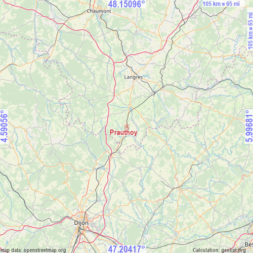
Prauthoy GPS coordinates[2]
47° 40' 46.956" North, 5° 17' 37.248" East
| Map corner | latitude | longitude |
|---|---|---|
| Upper-left | 48.15096°, | 4.59056° |
| Center: | 47.67971°, | 5.29368° |
| Lower-right: | 47.20417°, | 5.99681° |
| Map W x H: | 105.3×105.3 km | = 65.4×65.4mi |
| max Lat: | 51.07786° ⇑46.1% North |
| Prauthoy: | 47.67971° |
| min Lat: | ⇓53.9% South 41.3874° |
| min Long | Prauthoy | max Long |
| -5.08615° | 5.29368° | 9.52242° |
| W 80.6%⇐ | ⇒19.4% E |
Elevation
Elevation of Prauthoy is 304 m = 997 ft, and this is 110.3 m = 362 ft above average elevation for this country.
| Max E: |
2333 m = 7654 ft | 18.6% |
| Prauthoy | 304 m 997 ft | |
| Avg. | 193.7 m = 635 ft | |
Min E: |
-1 m = -3 ft | 81.4% |
See also: France elevation on elevation.city.
Geographical zone
Prauthoy is located in North temperate zone (between Tropic of Cancer and the Arctic Circle). Distance of this North polar circle is 2099.7 km =1304.7 mi to North.| Distance of | km | miles | from Prauthoy |
|---|---|---|---|
| North Pole | 4705.6 | 2923.9 | to North |
| Arctic Circle | 2099.7 | 1304.7 | to North |
| Tropic Cancer | 2695.6 | 1675 | to South |
| Equator | 5301.5 | 3294.2 | to South |


Nearby cities:
15 places around Prauthoy: (largest is in red/bold)
• Chalindrey
17 km =10.6 mi,  36°
36°
• Champlitte
18.1 km =11.2 mi,  112°
112°
• Champlitte-la-Ville
19.3 km =12 mi, 112°
• Culmont
19.4 km =12.1 mi,  34°
34°
• Fontaine-Française
19.1 km =11.9 mi,  161°
161°
• Langres
20.6 km =12.8 mi,  8°
8°
• Longeau-Percey
9.7 km =6 mi,  2°
2°
• Lux
22.1 km =13.7 mi,  196°
196°
• Marcilly-sur-Tille
21.9 km =13.6 mi,  214°
214°
• Saints-Geosmes
17.3 km =10.7 mi, 9°
• Selongey
13 km =8.1 mi,  218°
218°
• Til-Châtel
20.3 km =12.6 mi, 206°
• Torcenay
19.8 km =12.3 mi, 40°
• Vaux-sous-Aubigny
2.8 km =1.7 mi,  189°
189°
• Villegusien-le-Lac
6.6 km =4.1 mi,  18°
18°
Sources, notices
• [Note1] Compared only with cities in France existing in our database
• [Src1] Map data: © OpenStreetMap contributors (CC-BY-SA)
• [Src2] Other city data from geonames.org with taken over terms of usage.
• [Src3] Geographical zone / Annual Mean Temperature by Robert A. Rohde @ Wikipedia
