Fayl-Billot geodata
Fayl-Billot (Grand Est) is a populated place; located in France in Europe/Paris (GMT+2) time zone. With population of 1,609 people, there are 5807 cities with bigger population in this country. Compared to other cities in France, 55.5% of cities are located further ↓South; 83.7% of cities are located further ←West and 83.5% of cities have lower elevation than Fayl-Billot. Note1
Administrative division(s):
- Level 1: Grand Est
- Level 2: Haute-Marne
- Level 3: Arrondissement de Langres
- Level 4: Fayl-Billot


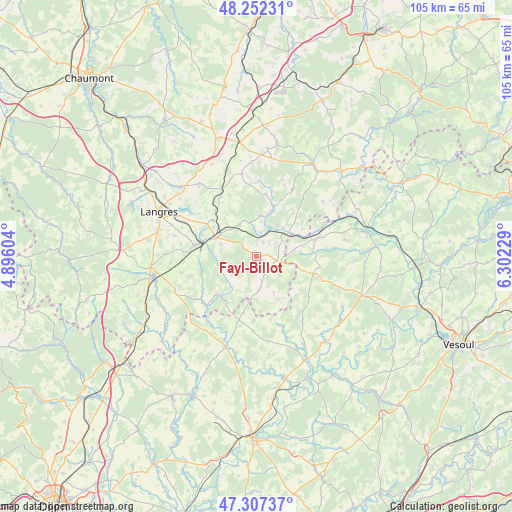
Fayl-Billot GPS coordinates[2]
47° 46' 55.164" North, 5° 35' 57.012" East
| Map corner | latitude | longitude |
|---|---|---|
| Upper-left | 48.25231°, | 4.89604° |
| Center: | 47.78199°, | 5.59917° |
| Lower-right: | 47.30737°, | 6.30229° |
| Map W x H: | 105.1×105.1 km | = 65.3×65.3mi |
| max Lat: | 51.07786° ⇑44.5% North |
| Fayl-Billot: | 47.78199° |
| min Lat: | ⇓55.5% South 41.3874° |
| min Long | Fayl-Billot | max Long |
| -5.08615° | 5.59917° | 9.52242° |
| W 83.7%⇐ | ⇒16.3% E |
Elevation
Elevation of Fayl-Billot is 328 m = 1076 ft, and this is 134.3 m = 441 ft above average elevation for this country.
| Max E: |
2333 m = 7654 ft | 16.5% |
| Fayl-Billot | 328 m 1076 ft | |
| Avg. | 193.7 m = 635 ft | |
Min E: |
-1 m = -3 ft | 83.5% |
See also: France elevation on elevation.city.
Geographical zone
Fayl-Billot is located in North temperate zone (between Tropic of Cancer and the Arctic Circle). Distance of this North polar circle is 2088.3 km =1297.6 mi to North.| Distance of | km | miles | from Fayl-Billot |
|---|---|---|---|
| North Pole | 4694.2 | 2916.8 | to North |
| Arctic Circle | 2088.3 | 1297.6 | to North |
| Tropic Cancer | 2706.9 | 1682 | to South |
| Equator | 5312.9 | 3301.3 | to South |


Nearby cities:
15 places around Fayl-Billot: (largest is in red/bold)
• Avrecourt
20.7 km =12.9 mi,  347°
347°
• Bourbonne-les-Bains
22 km =13.7 mi,  30°
30°
• Chalindrey
13 km =8.1 mi,  280°
280°
• Champlitte
19.4 km =12.1 mi,  198°
198°
• Champlitte-la-Ville
19.4 km =12.1 mi, 195°
• Chézeaux
11.2 km =7 mi,  19°
19°
• Culmont
12.6 km =7.8 mi,  291°
291°
• Haute-Amance
6.8 km =4.2 mi,  327°
327°
• Jussey
23.1 km =14.4 mi,  77°
77°
• Langres
21.8 km =13.5 mi, 294°
• Longeau-Percey
22.4 km =13.9 mi,  265°
265°
• Saints-Geosmes
20.7 km =12.9 mi, 286°
• Saulxures
19.3 km =12 mi,  356°
356°
• Torcenay
10.6 km =6.6 mi, 290°
• Villegusien-le-Lac
21.4 km =13.3 mi,  256°
256°
Sources, notices
• [Note1] Compared only with cities in France existing in our database
• [Src1] Map data: © OpenStreetMap contributors (CC-BY-SA)
• [Src2] Other city data from geonames.org with taken over terms of usage.
• [Src3] Geographical zone / Annual Mean Temperature by Robert A. Rohde @ Wikipedia
