Champdieu geodata
Champdieu (Auvergne-Rhône-Alpes) is a populated place; located in France in Europe/Paris (GMT+2) time zone. With population of 1,513 people, there are 6147 cities with bigger population in this country. Compared to other cities in France, 71.8% of cities are located further ↑North; 68.3% of cities are located further ←West and 87.9% of cities have lower elevation than Champdieu. Note1
Administrative division(s):
- Level 1: Auvergne-Rhône-Alpes
- Level 2: Département de la Loire
- Level 3: Arrondissement de Montbrison
- Level 4: Champdieu


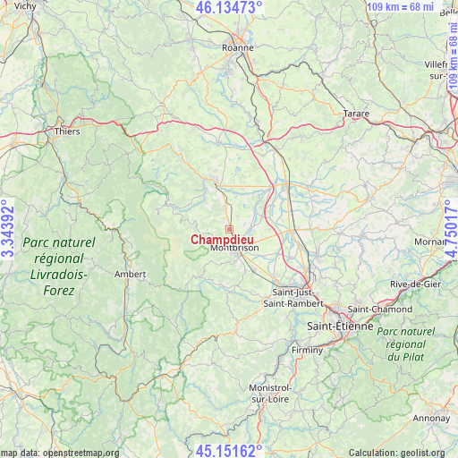
Champdieu GPS coordinates[2]
45° 38' 43.188" North, 4° 2' 49.38" East
| Map corner | latitude | longitude |
|---|---|---|
| Upper-left | 46.13473°, | 3.34392° |
| Center: | 45.64533°, | 4.04705° |
| Lower-right: | 45.15162°, | 4.75017° |
| Map W x H: | 109.3×109.3 km | = 67.9×67.9mi |
| max Lat: | 51.07786° ⇑71.8% North |
| Champdieu: | 45.64533° |
| min Lat: | ⇓28.2% South 41.3874° |
| min Long | Champdieu | max Long |
| -5.08615° | 4.04705° | 9.52242° |
| W 68.3%⇐ | ⇒31.7% E |
Elevation
Elevation of Champdieu is 388 m = 1273 ft, and this is 194.3 m = 637 ft above average elevation for this country.
| Max E: |
2333 m = 7654 ft | 12.1% |
| Champdieu | 388 m 1273 ft | |
| Avg. | 193.7 m = 635 ft | |
Min E: |
-1 m = -3 ft | 87.9% |
See also: France elevation on elevation.city.
Geographical zone
Champdieu is located in North temperate zone (between Tropic of Cancer and the Arctic Circle). Distance of this North polar circle is 2325.9 km =1445.2 mi to North.| Distance of | km | miles | from Champdieu |
|---|---|---|---|
| North Pole | 4931.8 | 3064.5 | to North |
| Arctic Circle | 2325.9 | 1445.2 | to North |
| Tropic Cancer | 2469.4 | 1534.4 | to South |
| Equator | 5075.3 | 3153.6 | to South |


Nearby cities:
15 places around Champdieu: (largest is in red/bold)
• Bard
7 km =4.3 mi,  204°
204°
• Essertines-en-Châtelneuf
4.9 km =3 mi,  232°
232°
• Lézigneux
8.9 km =5.5 mi,  170°
170°
• Marcilly-le-Châtel
5.8 km =3.6 mi,  347°
347°
• Marcoux
7.7 km =4.8 mi,  339°
339°
• Montbrison
4.4 km =2.7 mi,  161°
161°
• Montverdun
8.4 km =5.2 mi,  11°
11°
• Pralong
2.7 km =1.7 mi,  330°
330°
• Saint-Bonnet-le-Courreau
8.1 km =5 mi,  282°
282°
• Saint-Thomas-la-Garde
9.1 km =5.7 mi, 163°
• Saint-Étienne-le-Molard
10.4 km =6.5 mi,  18°
18°
• Sainte-Agathe-la-Bouteresse
10.3 km =6.4 mi,  355°
355°
• Savigneux
4.3 km =2.7 mi,  138°
138°
• Trelins
9.7 km =6 mi, 341°
• Verrières-en-Forez
9.1 km =5.7 mi,  206°
206°
Sources, notices
• [Note1] Compared only with cities in France existing in our database
• [Src1] Map data: © OpenStreetMap contributors (CC-BY-SA)
• [Src2] Other city data from geonames.org with taken over terms of usage.
• [Src3] Geographical zone / Annual Mean Temperature by Robert A. Rohde @ Wikipedia
