Verrières-en-Forez geodata
Verrières-en-Forez (Auvergne-Rhône-Alpes) is a populated place; located in France in Europe/Paris (GMT+2) time zone. With population of 693 people, there are 11901 cities with bigger population in this country. Compared to other cities in France, 73% of cities are located further ↑North; 67.8% of cities are located further ←West and 97.7% of cities have lower elevation than Verrières-en-Forez. Note1
Administrative division(s):
- Level 1: Auvergne-Rhône-Alpes
- Level 2: Département de la Loire
- Level 3: Arrondissement de Montbrison
- Level 4: Verrières-en-Forez


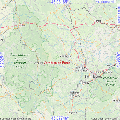
Verrières-en-Forez GPS coordinates[2]
45° 34' 18.516" North, 3° 59' 44.304" East
| Map corner | latitude | longitude |
|---|---|---|
| Upper-left | 46.06185°, | 3.29251° |
| Center: | 45.57181°, | 3.99564° |
| Lower-right: | 45.07746°, | 4.69876° |
| Map W x H: | 109.5×109.5 km | = 68×68mi |
| max Lat: | 51.07786° ⇑73% North |
| Verrières-en-Forez: | 45.57181° |
| min Lat: | ⇓27% South 41.3874° |
| min Long | Verrières-en-F | max Long |
| -5.08615° | 3.99564° | 9.52242° |
| W 67.8%⇐ | ⇒32.2% E |
Elevation
Elevation of Verrières-en-Forez is 796 m = 2612 ft, and this is 602.3 m = 1976 ft above average elevation for this country.
| Max E: |
2333 m = 7654 ft | 2.3% |
| Verrières-en-Forez | 796 m 2612 ft | |
| Avg. | 193.7 m = 635 ft | |
Min E: |
-1 m = -3 ft | 97.7% |
See also: France elevation on elevation.city.
Geographical zone
Verrières-en-Forez is located in North temperate zone (between Tropic of Cancer and the Arctic Circle). Distance of this North polar circle is 2334.1 km =1450.3 mi to North.| Distance of | km | miles | from Verrières-en-Forez |
|---|---|---|---|
| North Pole | 4940 | 3069.6 | to North |
| Arctic Circle | 2334.1 | 1450.3 | to North |
| Tropic Cancer | 2461.2 | 1529.3 | to South |
| Equator | 5067.1 | 3148.5 | to South |


Nearby cities:
15 places around Verrières-en-Forez: (largest is in red/bold)
• Bard
2.1 km =1.3 mi,  32°
32°
• Boisset-Saint-Priest
10.7 km =6.6 mi,  127°
127°
• Champdieu
9.1 km =5.7 mi, 26°
• Essertines-en-Châtelneuf
5.2 km =3.2 mi,  1°
1°
• Lézigneux
5.5 km =3.4 mi,  96°
96°
• Margerie-Chantagret
7.6 km =4.7 mi, 132°
• Montbrison
6.7 km =4.2 mi,  53°
53°
• Pralong
10.9 km =6.8 mi,  14°
14°
• Saint-Anthème
7.8 km =4.8 mi,  231°
231°
• Saint-Bonnet-le-Courreau
10.7 km =6.6 mi,  338°
338°
• Saint-Georges-Haute-Ville
8.1 km =5 mi, 101°
• Saint-Jean-Soleymieux
8.5 km =5.3 mi,  156°
156°
• Saint-Romain-le-Puy
10 km =6.2 mi, 98°
• Saint-Thomas-la-Garde
6.6 km =4.1 mi, 95°
• Savigneux
8.5 km =5.3 mi, 53°
Sources, notices
• [Note1] Compared only with cities in France existing in our database
• [Src1] Map data: © OpenStreetMap contributors (CC-BY-SA)
• [Src2] Other city data from geonames.org with taken over terms of usage.
• [Src3] Geographical zone / Annual Mean Temperature by Robert A. Rohde @ Wikipedia
