Bard geodata
Bard (Auvergne-Rhône-Alpes) is a populated place; located in France in Europe/Paris (GMT+2) time zone. With population of 618 people, there are 13020 cities with bigger population in this country. Compared to other cities in France, 72.8% of cities are located further ↑North; 67.9% of cities are located further ←West and 95.7% of cities have lower elevation than Bard. Note1
Administrative division(s):
- Level 1: Auvergne-Rhône-Alpes
- Level 2: Département de la Loire
- Level 3: Arrondissement de Montbrison
- Level 4: Bard


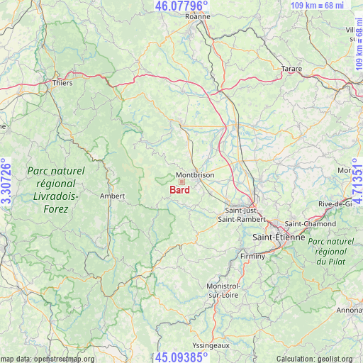
Bard GPS coordinates[2]
45° 35' 17.016" North, 4° 0' 37.404" East
| Map corner | latitude | longitude |
|---|---|---|
| Upper-left | 46.07796°, | 3.30726° |
| Center: | 45.58806°, | 4.01039° |
| Lower-right: | 45.09385°, | 4.71351° |
| Map W x H: | 109.4×109.4 km | = 68×68mi |
| max Lat: | 51.07786° ⇑72.8% North |
| Bard: | 45.58806° |
| min Lat: | ⇓27.2% South 41.3874° |
| min Long | Bard | max Long |
| -5.08615° | 4.01039° | 9.52242° |
| W 67.9%⇐ | ⇒32.1% E |
Elevation
Elevation of Bard is 626 m = 2054 ft, and this is 432.3 m = 1418 ft above average elevation for this country.
| Max E: |
2333 m = 7654 ft | 4.3% |
| Bard | 626 m 2054 ft | |
| Avg. | 193.7 m = 635 ft | |
Min E: |
-1 m = -3 ft | 95.7% |
See also: France elevation on elevation.city.
Geographical zone
Bard is located in North temperate zone (between Tropic of Cancer and the Arctic Circle). Distance of this North polar circle is 2332.3 km =1449.2 mi to North.| Distance of | km | miles | from Bard |
|---|---|---|---|
| North Pole | 4938.1 | 3068.4 | to North |
| Arctic Circle | 2332.3 | 1449.2 | to North |
| Tropic Cancer | 2463 | 1530.4 | to South |
| Equator | 5068.9 | 3149.7 | to South |


Nearby cities:
15 places around Bard: (largest is in red/bold)
• Champdieu
7 km =4.3 mi,  24°
24°
• Essertines-en-Châtelneuf
3.6 km =2.2 mi,  343°
343°
• Lézigneux
4.9 km =3 mi,  119°
119°
• Margerie-Chantagret
8.3 km =5.2 mi,  147°
147°
• Montbrison
4.8 km =3 mi,  63°
63°
• Pralong
8.8 km =5.5 mi,  9°
9°
• Précieux
11 km =6.8 mi,  90°
90°
• Saint-Anthème
9.9 km =6.2 mi,  227°
227°
• Saint-Bonnet-le-Courreau
9.6 km =6 mi,  327°
327°
• Saint-Georges-Haute-Ville
7.6 km =4.7 mi, 116°
• Saint-Jean-Soleymieux
9.9 km =6.2 mi,  167°
167°
• Saint-Romain-le-Puy
9.4 km =5.8 mi,  110°
110°
• Saint-Thomas-la-Garde
5.9 km =3.7 mi, 113°
• Savigneux
6.5 km =4 mi, 60°
• Verrières-en-Forez
2.1 km =1.3 mi,  212°
212°
Sources, notices
• [Note1] Compared only with cities in France existing in our database
• [Src1] Map data: © OpenStreetMap contributors (CC-BY-SA)
• [Src2] Other city data from geonames.org with taken over terms of usage.
• [Src3] Geographical zone / Annual Mean Temperature by Robert A. Rohde @ Wikipedia
