Lézigneux geodata
Lézigneux (Auvergne-Rhône-Alpes) is a populated place; located in France in Europe/Paris (GMT+1) time zone. With population of 1,174 people, there are 7680 cities with bigger population in this country. Compared to other cities in France, 73.1% of cities are located further ↑North; 68.5% of cities are located further ←West and 93.4% of cities have lower elevation than Lézigneux. Note1
Administrative division(s):
- Level 1: Auvergne-Rhône-Alpes
- Level 2: Département de la Loire
- Level 3: Arrondissement de Montbrison
- Level 4: Lézigneux


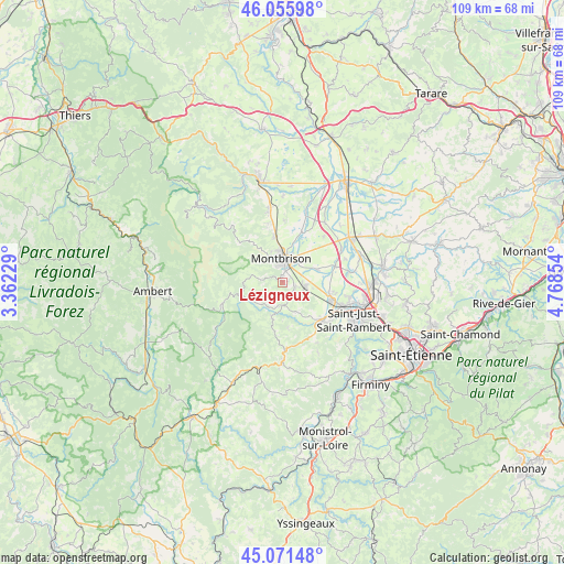
Lézigneux GPS coordinates[2]
45° 33' 57.204" North, 4° 3' 55.512" East
| Map corner | latitude | longitude |
|---|---|---|
| Upper-left | 46.05598°, | 3.36229° |
| Center: | 45.56589°, | 4.06542° |
| Lower-right: | 45.07148°, | 4.76854° |
| Map W x H: | 109.5×109.5 km | = 68×68mi |
| max Lat: | 51.07786° ⇑73.1% North |
| Lézigneux: | 45.56589° |
| min Lat: | ⇓26.9% South 41.3874° |
| min Long | Lézigneux | max Long |
| -5.08615° | 4.06542° | 9.52242° |
| W 68.5%⇐ | ⇒31.5% E |
Elevation
Elevation of Lézigneux is 518 m = 1699 ft, and this is 324.3 m = 1064 ft above average elevation for this country.
| Max E: |
2333 m = 7654 ft | 6.6% |
| Lézigneux | 518 m 1699 ft | |
| Avg. | 193.7 m = 635 ft | |
Min E: |
-1 m = -3 ft | 93.4% |
See also: France elevation on elevation.city.
Geographical zone
Lézigneux is located in North temperate zone (between Tropic of Cancer and the Arctic Circle). Distance of this North polar circle is 2334.7 km =1450.7 mi to North.| Distance of | km | miles | from Lézigneux |
|---|---|---|---|
| North Pole | 4940.6 | 3069.9 | to North |
| Arctic Circle | 2334.7 | 1450.7 | to North |
| Tropic Cancer | 2460.5 | 1528.9 | to South |
| Equator | 5066.5 | 3148.2 | to South |


Nearby cities:
15 places around Lézigneux: (largest is in red/bold)
• Bard
4.9 km =3 mi,  299°
299°
• Boisset-Saint-Priest
6.6 km =4.1 mi,  152°
152°
• Champdieu
8.9 km =5.5 mi,  350°
350°
• Essertines-en-Châtelneuf
7.9 km =4.9 mi,  318°
318°
• Margerie-Chantagret
4.5 km =2.8 mi,  177°
177°
• Montbrison
4.6 km =2.9 mi,  359°
359°
• Précieux
7.1 km =4.4 mi,  70°
70°
• Saint-Georges-Haute-Ville
2.7 km =1.7 mi,  111°
111°
• Saint-Jean-Soleymieux
7.5 km =4.7 mi,  196°
196°
• Saint-Marcellin-en-Forez
11.3 km =7 mi,  132°
132°
• Saint-Romain-le-Puy
4.6 km =2.9 mi,  100°
100°
• Saint-Thomas-la-Garde
1.1 km =0.7 mi,  86°
86°
• Savigneux
5.8 km =3.6 mi,  13°
13°
• Sury-le-Comtal
9.9 km =6.2 mi, 108°
• Verrières-en-Forez
5.5 km =3.4 mi,  276°
276°
Sources, notices
• [Note1] Compared only with cities in France existing in our database
• [Src1] Map data: © OpenStreetMap contributors (CC-BY-SA)
• [Src2] Other city data from geonames.org with taken over terms of usage.
• [Src3] Geographical zone / Annual Mean Temperature by Robert A. Rohde @ Wikipedia
