Dordives geodata
Dordives (Centre) is a populated place; located in France in Europe/Paris (GMT+2) time zone. With population of 2,749 people, there are 3561 cities with bigger population in this country. Compared to other cities in France, 61.9% of cities are located further ↓South; 54.5% of cities are located further ←West and 73.1% of cities have higher elevation than Dordives. Note1
Administrative division(s):
- Level 1: Centre
- Level 2: Loiret
- Level 3: Arrondissement de Montargis
- Level 4: Dordives


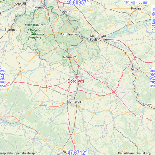
Dordives GPS coordinates[2]
48° 8' 33.108" North, 2° 46' 3.9" East
| Map corner | latitude | longitude |
|---|---|---|
| Upper-left | 48.60957°, | 2.06463° |
| Center: | 48.14253°, | 2.76775° |
| Lower-right: | 47.6712°, | 3.47088° |
| Map W x H: | 104.3×104.3 km | = 64.8×64.8mi |
| max Lat: | 51.07786° ⇑38.1% North |
| Dordives: | 48.14253° |
| min Lat: | ⇓61.9% South 41.3874° |
| min Long | Dordives | max Long |
| -5.08615° | 2.76775° | 9.52242° |
| W 54.5%⇐ | ⇒45.5% E |
Elevation
Elevation of Dordives is 71 m = 233 ft, and this is 122.7 m = 403 ft below average elevation for this country.
| Max E: |
2333 m = 7654 ft | 73.1% |
| Avg. | 193.7 m = 635 ft | |
| Dordives | 71 m = 233 ft | |
Min E: |
-1 m = -3 ft | 26.9% |
See also: France elevation on elevation.city.
Geographical zone
Dordives is located in North temperate zone (between Tropic of Cancer and the Arctic Circle). Distance of this North polar circle is 2048.2 km =1272.7 mi to North.| Distance of | km | miles | from Dordives |
|---|---|---|---|
| North Pole | 4654.1 | 2891.9 | to North |
| Arctic Circle | 2048.2 | 1272.7 | to North |
| Tropic Cancer | 2747 | 1706.9 | to South |
| Equator | 5352.9 | 3326.1 | to South |


Nearby cities:
15 places around Dordives: (largest is in red/bold)
• Bagneaux-sur-Loing
11 km =6.8 mi,  335°
335°
• Bougligny
10.1 km =6.3 mi,  306°
306°
• Bransles
4.9 km =3 mi,  76°
76°
• Cepoy
10.7 km =6.6 mi,  191°
191°
• Chaintreaux
7.4 km =4.6 mi,  31°
31°
• Château-Landon
5.2 km =3.2 mi,  275°
275°
• Corquilleroy
12.1 km =7.5 mi,  203°
203°
• Fontenay-sur-Loing
4.4 km =2.7 mi,  172°
172°
• Girolles
9.8 km =6.1 mi, 203°
• Griselles
8 km =5 mi,  145°
145°
• Nargis
3.6 km =2.2 mi, 194°
• Paucourt
11.8 km =7.3 mi, 170°
• Poligny
9.2 km =5.7 mi,  349°
349°
• Souppes-sur-Loing
5.1 km =3.2 mi,  331°
331°
• Égreville
8.6 km =5.3 mi,  64°
64°
Sources, notices
• [Note1] Compared only with cities in France existing in our database
• [Src1] Map data: © OpenStreetMap contributors (CC-BY-SA)
• [Src2] Other city data from geonames.org with taken over terms of usage.
• [Src3] Geographical zone / Annual Mean Temperature by Robert A. Rohde @ Wikipedia
