Caussade geodata
Caussade (Occitanie) is a populated place; located in France in Europe/Paris (GMT+2) time zone. With population of 6,333 people, there are 1566 cities with bigger population in this country. Compared to other cities in France, 85.8% of cities are located further ↑North; 62.5% of cities are located further →East and 54.4% of cities have higher elevation than Caussade. Note1
Administrative division(s):
- Level 1: Occitanie
- Level 2: Département du Tarn-et-Garonne
- Level 3: Arrondissement de Montauban
- Level 4: Caussade


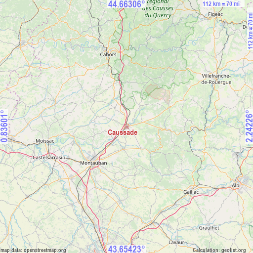
Caussade GPS coordinates[2]
44° 9' 38.88" North, 1° 32' 20.868" East
| Map corner | latitude | longitude |
|---|---|---|
| Upper-left | 44.66306°, | 0.83601° |
| Center: | 44.1608°, | 1.53913° |
| Lower-right: | 43.65423°, | 2.24226° |
| Map W x H: | 112.2×112.2 km | = 69.7×69.7mi |
| max Lat: | 51.07786° ⇑85.8% North |
| Caussade: | 44.1608° |
| min Lat: | ⇓14.2% South 41.3874° |
| min Long | Caussade | max Long |
| -5.08615° | 1.53913° | 9.52242° |
| W 37.5%⇐ | ⇒62.5% E |
Elevation
Elevation of Caussade is 118 m = 387 ft, and this is 75.7 m = 248 ft below average elevation for this country.
| Max E: |
2333 m = 7654 ft | 54.4% |
| Avg. | 193.7 m = 635 ft | |
| Caussade | 118 m = 387 ft | |
Min E: |
-1 m = -3 ft | 45.6% |
See also: France elevation on elevation.city.
Geographical zone
Caussade is located in North temperate zone (between Tropic of Cancer and the Arctic Circle). Distance of this Northern Tropic circle is 2304.3 km =1431.8 mi to South.| Distance of | km | miles | from Caussade |
|---|---|---|---|
| North Pole | 5096.8 | 3167 | to North |
| Arctic Circle | 2491 | 1547.8 | to North |
| Tropic Cancer | 2304.3 | 1431.8 | to South |
| Equator | 4910.2 | 3051.1 | to South |


Nearby cities:
15 places around Caussade: (largest is in red/bold)
• Albias
10.7 km =6.6 mi,  222°
222°
• Belfort-du-Quercy
12 km =7.5 mi,  1°
1°
• Bioule
7.9 km =4.9 mi,  180°
180°
• Mirabel
9.6 km =6 mi,  258°
258°
• Molières
14.5 km =9 mi,  284°
284°
• Montalzat
6.1 km =3.8 mi,  329°
329°
• Monteils
3.1 km =1.9 mi,  73°
73°
• Montpezat-de-Quercy
10 km =6.2 mi, 330°
• Montricoux
11.4 km =7.1 mi,  145°
145°
• Nègrepelisse
9.7 km =6 mi,  189°
189°
• Puylaroque
11.5 km =7.1 mi,  29°
29°
• Réalville
7 km =4.3 mi, 222°
• Saint-Etienne-de-Tulmont
13.6 km =8.5 mi,  205°
205°
• Septfonds
6.6 km =4.1 mi, 72°
• Vaïssac
14.3 km =8.9 mi,  171°
171°
Sources, notices
• [Note1] Compared only with cities in France existing in our database
• [Src1] Map data: © OpenStreetMap contributors (CC-BY-SA)
• [Src2] Other city data from geonames.org with taken over terms of usage.
• [Src3] Geographical zone / Annual Mean Temperature by Robert A. Rohde @ Wikipedia
