Castanet-Tolosan geodata
Castanet-Tolosan (Occitanie) is a populated place; located in France in Europe/Paris (GMT+2) time zone. With population of 11,561 people, there are 832 cities with bigger population in this country. Compared to other cities in France, 92.9% of cities are located further ↑North; 63% of cities are located further →East and 59.3% of cities have lower elevation than Castanet-Tolosan. Note1
Administrative division(s):
- Level 1: Occitanie
- Level 2: Haute-Garonne
- Level 3: Arrondissement de Toulouse
- Level 4: Castanet-Tolosan


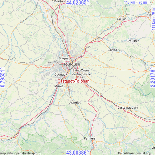
Castanet-Tolosan GPS coordinates[2]
43° 30' 57.276" North, 1° 29' 55.104" East
| Map corner | latitude | longitude |
|---|---|---|
| Upper-left | 44.02365°, | 0.79551° |
| Center: | 43.51591°, | 1.49864° |
| Lower-right: | 43.00386°, | 2.20176° |
| Map W x H: | 113.4×113.4 km | = 70.5×70.5mi |
| max Lat: | 51.07786° ⇑92.9% North |
| Castanet-Tolosan: | 43.51591° |
| min Lat: | ⇓7.1% South 41.3874° |
| min Long | Castanet-Tolosa | max Long |
| -5.08615° | 1.49864° | 9.52242° |
| W 37%⇐ | ⇒63% E |
Elevation
Elevation of Castanet-Tolosan is 167 m = 548 ft, and this is 26.7 m = 88 ft below average elevation for this country.
| Max E: |
2333 m = 7654 ft | 40.7% |
| Avg. | 193.7 m = 635 ft | |
| Castanet-Tolosan | 167 m = 548 ft | |
Min E: |
-1 m = -3 ft | 59.3% |
See also: France elevation on elevation.city.
Geographical zone
Castanet-Tolosan is located in North temperate zone (between Tropic of Cancer and the Arctic Circle). Distance of this Northern Tropic circle is 2232.6 km =1387.3 mi to South.| Distance of | km | miles | from Castanet-Tolosan |
|---|---|---|---|
| North Pole | 5168.5 | 3211.6 | to North |
| Arctic Circle | 2562.7 | 1592.4 | to North |
| Tropic Cancer | 2232.6 | 1387.3 | to South |
| Equator | 4838.5 | 3006.5 | to South |


Nearby cities:
15 places around Castanet-Tolosan: (largest is in red/bold)
• Aureville
5.4 km =3.4 mi,  224°
224°
• Auzeville-Tolosane
1.9 km =1.2 mi,  315°
315°
• Auzielle
6.1 km =3.8 mi,  62°
62°
• Belberaud
5.7 km =3.5 mi,  101°
101°
• Corronsac
4.7 km =2.9 mi,  181°
181°
• Deyme
4.4 km =2.7 mi,  150°
150°
• Escalquens
4.9 km =3 mi,  87°
87°
• Labège
3.4 km =2.1 mi, 61°
• Pechbusque
3.7 km =2.3 mi,  293°
293°
• Pompertuzat
2.9 km =1.8 mi, 152°
• Péchabou
1.7 km =1.1 mi, 150°
• Ramonville-Saint-Agne
3.9 km =2.4 mi,  330°
330°
• Saint-Orens-de-Gameville
5.1 km =3.2 mi,  34°
34°
• Vieille-Toulouse
4.6 km =2.9 mi,  280°
280°
• Vigoulet-Auzil
3.3 km =2.1 mi,  252°
252°
Sources, notices
• [Note1] Compared only with cities in France existing in our database
• [Src1] Map data: © OpenStreetMap contributors (CC-BY-SA)
• [Src2] Other city data from geonames.org with taken over terms of usage.
• [Src3] Geographical zone / Annual Mean Temperature by Robert A. Rohde @ Wikipedia
