Cantin geodata
Cantin (Hauts-de-France) is a populated place; located in France in Europe/Paris (GMT+2) time zone. With population of 1,455 people, there are 6350 cities with bigger population in this country. Compared to other cities in France, 95.7% of cities are located further ↓South; 59.6% of cities are located further ←West and 84.1% of cities have higher elevation than Cantin. Note1
Administrative division(s):
- Level 1: Hauts-de-France
- Level 2: Nord
- Level 3: Arrondissement de Douai
- Level 4: Cantin


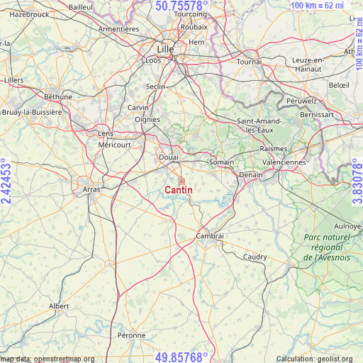
Cantin GPS coordinates[2]
50° 18' 31.86" North, 3° 7' 39.54" East
| Map corner | latitude | longitude |
|---|---|---|
| Upper-left | 50.75578°, | 2.42453° |
| Center: | 50.30885°, | 3.12765° |
| Lower-right: | 49.85768°, | 3.83078° |
| Map W x H: | 99.9×99.9 km | = 62.1×62.1mi |
| max Lat: | 51.07786° ⇑4.3% North |
| Cantin: | 50.30885° |
| min Lat: | ⇓95.7% South 41.3874° |
| min Long | Cantin | max Long |
| -5.08615° | 3.12765° | 9.52242° |
| W 59.6%⇐ | ⇒40.4% E |
Elevation
Elevation of Cantin is 44 m = 144 ft, and this is 149.7 m = 491 ft below average elevation for this country.
| Max E: |
2333 m = 7654 ft | 84.1% |
| Avg. | 193.7 m = 635 ft | |
| Cantin | 44 m = 144 ft | |
Min E: |
-1 m = -3 ft | 15.9% |
See also: France elevation on elevation.city.
Geographical zone
Cantin is located in North temperate zone (between Tropic of Cancer and the Arctic Circle). Distance of this North polar circle is 1807.4 km =1123.1 mi to North.| Distance of | km | miles | from Cantin |
|---|---|---|---|
| North Pole | 4413.2 | 2742.2 | to North |
| Arctic Circle | 1807.4 | 1123.1 | to North |
| Tropic Cancer | 2987.9 | 1856.6 | to South |
| Equator | 5593.8 | 3475.8 | to South |


Nearby cities:
15 places around Cantin: (largest is in red/bold)
• Arleux
3.6 km =2.2 mi,  207°
207°
• Aubigny-au-Bac
5.7 km =3.5 mi,  152°
152°
• Bugnicourt
2.8 km =1.7 mi,  134°
134°
• Dechy
4.6 km =2.9 mi,  350°
350°
• Erchin
2.9 km =1.8 mi,  71°
71°
• Estrées
4.2 km =2.6 mi,  257°
257°
• Fressain
5.3 km =3.3 mi,  116°
116°
• Férin
4.3 km =2.7 mi,  298°
298°
• Gouy-sous-Bellonne
5.1 km =3.2 mi,  273°
273°
• Guesnain
4.8 km =3 mi,  19°
19°
• Gœulzin
2.1 km =1.3 mi,  293°
293°
• Hamel
5 km =3.1 mi,  229°
229°
• Lewarde
4.6 km =2.9 mi,  37°
37°
• Palluel
5.8 km =3.6 mi, 205°
• Villers-au-Tertre
3.9 km =2.4 mi,  101°
101°
Sources, notices
• [Note1] Compared only with cities in France existing in our database
• [Src1] Map data: © OpenStreetMap contributors (CC-BY-SA)
• [Src2] Other city data from geonames.org with taken over terms of usage.
• [Src3] Geographical zone / Annual Mean Temperature by Robert A. Rohde @ Wikipedia
