Caluire-et-Cuire geodata
Caluire-et-Cuire (Auvergne-Rhône-Alpes) is a populated place; located in France in Europe/Paris (GMT+2) time zone. With population of 42,763 people, there are 165 cities with bigger population in this country. Compared to other cities in France, 69.4% of cities are located further ↑North; 75.8% of cities are located further ←West and 73.2% of cities have lower elevation than Caluire-et-Cuire. Note1
Administrative division(s):
- Level 1: Auvergne-Rhône-Alpes
- Level 2: Département du Rhône
- Level 3: Arrondissement de Lyon
- Level 4: Caluire-et-Cuire


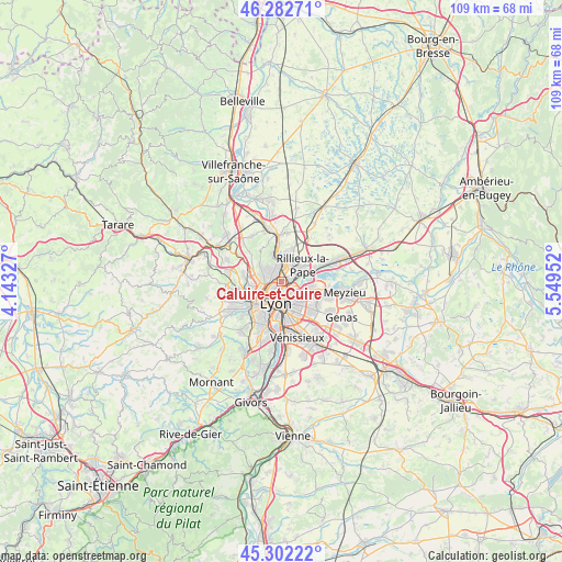
Caluire-et-Cuire GPS coordinates[2]
45° 47' 40.632" North, 4° 50' 47.04" East
| Map corner | latitude | longitude |
|---|---|---|
| Upper-left | 46.28271°, | 4.14327° |
| Center: | 45.79462°, | 4.8464° |
| Lower-right: | 45.30222°, | 5.54952° |
| Map W x H: | 109×109 km | = 67.7×67.7mi |
| max Lat: | 51.07786° ⇑69.4% North |
| Caluire-et-Cuire: | 45.79462° |
| min Lat: | ⇓30.6% South 41.3874° |
| min Long | Caluire-et-Cuir | max Long |
| -5.08615° | 4.8464° | 9.52242° |
| W 75.8%⇐ | ⇒24.2% E |
Elevation
Elevation of Caluire-et-Cuire is 237 m = 778 ft, and this is 43.3 m = 142 ft above average elevation for this country.
| Max E: |
2333 m = 7654 ft | 26.8% |
| Caluire-et-Cuire | 237 m 778 ft | |
| Avg. | 193.7 m = 635 ft | |
Min E: |
-1 m = -3 ft | 73.2% |
See also: Caluire-et-Cuire elevation on elevation.city.
Geographical zone
Caluire-et-Cuire is located in North temperate zone (between Tropic of Cancer and the Arctic Circle). Distance of this North polar circle is 2309.3 km =1434.9 mi to North.| Distance of | km | miles | from Caluire-et-Cuire |
|---|---|---|---|
| North Pole | 4915.2 | 3054.2 | to North |
| Arctic Circle | 2309.3 | 1434.9 | to North |
| Tropic Cancer | 2486 | 1544.7 | to South |
| Equator | 5091.9 | 3164 | to South |


Nearby cities:
15 places around Caluire-et-Cuire: (largest is in red/bold)
• Cailloux-sur-Fontaines
6.8 km =4.2 mi,  18°
18°
• Champagne-au-Mont-d’Or
4.3 km =2.7 mi,  270°
270°
• Couzon-au-Mont-d’Or
5.7 km =3.5 mi,  346°
346°
• Dardilly
7.3 km =4.5 mi,  279°
279°
• Fontaines-Saint-Martin
5.5 km =3.4 mi,  5°
5°
• Fontaines-sur-Saône
4.6 km =2.9 mi,  358°
358°
• Lyon
5.1 km =3.2 mi,  179°
179°
• Rillieux-la-Pape
4.8 km =3 mi,  59°
59°
• Rochetaillée-sur-Saône
6.2 km =3.9 mi,  2°
2°
• Sathonay-Camp
4 km =2.5 mi,  33°
33°
• Sathonay-Village
5 km =3.1 mi, 29°
• Tassin-la-Demi-Lune
6.3 km =3.9 mi,  225°
225°
• Vaulx-en-Velin
6.2 km =3.9 mi,  97°
97°
• Villeurbanne
4.1 km =2.5 mi,  141°
141°
• Écully
5.8 km =3.6 mi,  247°
247°
Sources, notices
• [Note1] Compared only with cities in France existing in our database
• [Src1] Map data: © OpenStreetMap contributors (CC-BY-SA)
• [Src2] Other city data from geonames.org with taken over terms of usage.
• [Src3] Geographical zone / Annual Mean Temperature by Robert A. Rohde @ Wikipedia
