Tassin-la-Demi-Lune geodata
Tassin-la-Demi-Lune (Auvergne-Rhône-Alpes) is a populated place; located in France in Europe/Paris (GMT+2) time zone. With population of 16,920 people, there are 562 cities with bigger population in this country. Compared to other cities in France, 70% of cities are located further ↑North; 74.9% of cities are located further ←West and 76.8% of cities have lower elevation than Tassin-la-Demi-Lune. Note1
Administrative division(s):
- Level 1: Auvergne-Rhône-Alpes
- Level 2: Département du Rhône
- Level 3: Arrondissement de Lyon
- Level 4: Lyon


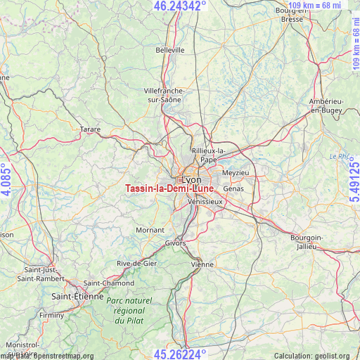
Tassin-la-Demi-Lune GPS coordinates[2]
45° 45' 17.964" North, 4° 47' 17.232" East
| Map corner | latitude | longitude |
|---|---|---|
| Upper-left | 46.24342°, | 4.085° |
| Center: | 45.75499°, | 4.78812° |
| Lower-right: | 45.26224°, | 5.49125° |
| Map W x H: | 109.1×109.1 km | = 67.8×67.8mi |
| max Lat: | 51.07786° ⇑70% North |
| Tassin-la-Demi-Lune: | 45.75499° |
| min Lat: | ⇓30% South 41.3874° |
| min Long | Tassin-la-Demi- | max Long |
| -5.08615° | 4.78812° | 9.52242° |
| W 74.9%⇐ | ⇒25.1% E |
Elevation
Elevation of Tassin-la-Demi-Lune is 262 m = 860 ft, and this is 68.3 m = 224 ft above average elevation for this country.
| Max E: |
2333 m = 7654 ft | 23.2% |
| Tassin-la-Demi-Lune | 262 m 860 ft | |
| Avg. | 193.7 m = 635 ft | |
Min E: |
-1 m = -3 ft | 76.8% |
See also: France elevation on elevation.city.
Geographical zone
Tassin-la-Demi-Lune is located in North temperate zone (between Tropic of Cancer and the Arctic Circle). Distance of this North polar circle is 2313.7 km =1437.7 mi to North.| Distance of | km | miles | from Tassin-la-Demi-Lune |
|---|---|---|---|
| North Pole | 4919.6 | 3056.9 | to North |
| Arctic Circle | 2313.7 | 1437.7 | to North |
| Tropic Cancer | 2481.6 | 1542 | to South |
| Equator | 5087.5 | 3161.2 | to South |


Nearby cities:
15 places around Tassin-la-Demi-Lune: (largest is in red/bold)
• Caluire-et-Cuire
6.3 km =3.9 mi,  45°
45°
• Champagne-au-Mont-d’Or
4.4 km =2.7 mi,  2°
2°
• Chaponost
6.1 km =3.8 mi,  215°
215°
• Charbonnières-les-Bains
4.3 km =2.7 mi,  311°
311°
• Craponne
5.2 km =3.2 mi,  257°
257°
• Dardilly
6.2 km =3.9 mi,  334°
334°
• Francheville
2.8 km =1.7 mi, 222°
• La Mulatière
3.5 km =2.2 mi,  147°
147°
• Lyon
4.6 km =2.9 mi,  99°
99°
• Oullins
4.8 km =3 mi,  161°
161°
• Pierre-Bénite
6.4 km =4 mi, 153°
• Saint-Genis-Laval
6.6 km =4.1 mi,  176°
176°
• Saint-Genis-les-Ollières
4.8 km =3 mi,  272°
272°
• Sainte-Foy-lès-Lyon
2.6 km =1.6 mi, 154°
• Écully
2.3 km =1.4 mi,  339°
339°
Sources, notices
• [Note1] Compared only with cities in France existing in our database
• [Src1] Map data: © OpenStreetMap contributors (CC-BY-SA)
• [Src2] Other city data from geonames.org with taken over terms of usage.
• [Src3] Geographical zone / Annual Mean Temperature by Robert A. Rohde @ Wikipedia
