Écully geodata
Écully (Auvergne-Rhône-Alpes) is a populated place; located in France in Europe/Paris (GMT+2) time zone. With population of 19,437 people, there are 473 cities with bigger population in this country. Compared to other cities in France, 69.7% of cities are located further ↑North; 74.8% of cities are located further ←West and 68.5% of cities have lower elevation than Écully. Note1
Administrative division(s):
- Level 1: Auvergne-Rhône-Alpes
- Level 2: Département du Rhône
- Level 3: Arrondissement de Lyon
- Level 4: Écully


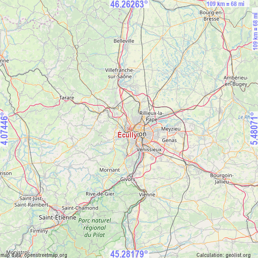
Écully GPS coordinates[2]
45° 46' 27.732" North, 4° 46' 39.288" East
| Map corner | latitude | longitude |
|---|---|---|
| Upper-left | 46.26263°, | 4.07446° |
| Center: | 45.77437°, | 4.77758° |
| Lower-right: | 45.28179°, | 5.48071° |
| Map W x H: | 109.1×109.1 km | = 67.8×67.8mi |
| max Lat: | 51.07786° ⇑69.7% North |
| Écully: | 45.77437° |
| min Lat: | ⇓30.3% South 41.3874° |
| min Long | Écully | max Long |
| -5.08615° | 4.77758° | 9.52242° |
| W 74.8%⇐ | ⇒25.2% E |
Elevation
Elevation of Écully is 211 m = 692 ft, and this is 17.3 m = 57 ft above average elevation for this country.
| Max E: |
2333 m = 7654 ft | 31.5% |
| Écully | 211 m 692 ft | |
| Avg. | 193.7 m = 635 ft | |
Min E: |
-1 m = -3 ft | 68.5% |
See also: France elevation on elevation.city.
Geographical zone
Écully is located in North temperate zone (between Tropic of Cancer and the Arctic Circle). Distance of this North polar circle is 2311.5 km =1436.3 mi to North.| Distance of | km | miles | from Écully |
|---|---|---|---|
| North Pole | 4917.4 | 3055.5 | to North |
| Arctic Circle | 2311.5 | 1436.3 | to North |
| Tropic Cancer | 2483.7 | 1543.3 | to South |
| Equator | 5089.6 | 3162.5 | to South |


Nearby cities:
15 places around Écully: (largest is in red/bold)
• Caluire-et-Cuire
5.8 km =3.6 mi,  67°
67°
• Champagne-au-Mont-d’Or
2.5 km =1.6 mi,  24°
24°
• Charbonnières-les-Bains
2.5 km =1.6 mi,  285°
285°
• Craponne
5.3 km =3.3 mi,  232°
232°
• Dardilly
4 km =2.5 mi,  331°
331°
• Francheville
4.4 km =2.7 mi,  194°
194°
• La Mulatière
5.8 km =3.6 mi,  152°
152°
• La Tour-de-Salvagny
6.4 km =4 mi,  312°
312°
• Limonest
7 km =4.3 mi,  356°
356°
• Lyon
6.1 km =3.8 mi,  118°
118°
• Oullins
7.1 km =4.4 mi,  160°
160°
• Saint-Genis-les-Ollières
4.4 km =2.7 mi,  244°
244°
• Sainte-Consorce
6.8 km =4.2 mi,  271°
271°
• Sainte-Foy-lès-Lyon
4.9 km =3 mi, 156°
• Tassin-la-Demi-Lune
2.3 km =1.4 mi, 159°
Sources, notices
• [Note1] Compared only with cities in France existing in our database
• [Src1] Map data: © OpenStreetMap contributors (CC-BY-SA)
• [Src2] Other city data from geonames.org with taken over terms of usage.
• [Src3] Geographical zone / Annual Mean Temperature by Robert A. Rohde @ Wikipedia
