Calan geodata
Calan (Brittany) is a populated place; located in France in Europe/Paris (GMT+2) time zone. With population of 773 people, there are 10903 cities with bigger population in this country. Compared to other cities in France, 57.1% of cities are located further ↓South; 98% of cities are located further →East and 58.7% of cities have higher elevation than Calan. Note1
Administrative division(s):
- Level 1: Brittany
- Level 2: Morbihan
- Level 3: Arrondissement de Lorient
- Level 4: Calan


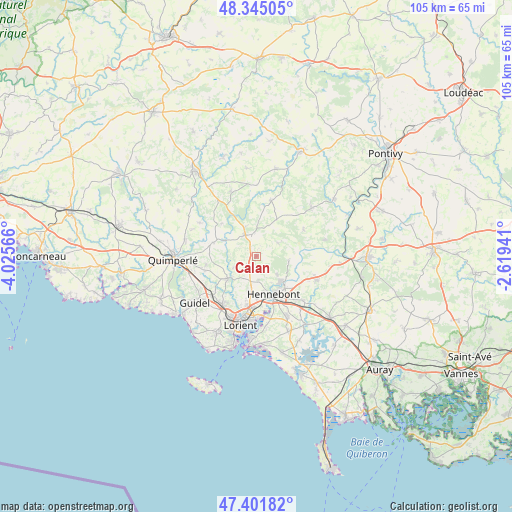
Calan GPS coordinates[2]
47° 52' 32.088" North, 3° 19' 21.108" West
| Map corner | latitude | longitude |
|---|---|---|
| Upper-left | 48.34505°, | -4.02566° |
| Center: | 47.87558°, | -3.32253° |
| Lower-right: | 47.40182°, | -2.61941° |
| Map W x H: | 104.9×104.9 km | = 65.2×65.2mi |
| max Lat: | 51.07786° ⇑42.9% North |
| Calan: | 47.87558° |
| min Lat: | ⇓57.1% South 41.3874° |
| min Long | Calan | max Long |
| -5.08615° | -3.32253° | 9.52242° |
| W 2%⇐ | ⇒98% E |
Elevation
Elevation of Calan is 106 m = 348 ft, and this is 87.7 m = 288 ft below average elevation for this country.
| Max E: |
2333 m = 7654 ft | 58.7% |
| Avg. | 193.7 m = 635 ft | |
| Calan | 106 m = 348 ft | |
Min E: |
-1 m = -3 ft | 41.3% |
See also: France elevation on elevation.city.
Geographical zone
Calan is located in North temperate zone (between Tropic of Cancer and the Arctic Circle). Distance of this North polar circle is 2077.9 km =1291.1 mi to North.| Distance of | km | miles | from Calan |
|---|---|---|---|
| North Pole | 4683.8 | 2910.4 | to North |
| Arctic Circle | 2077.9 | 1291.1 | to North |
| Tropic Cancer | 2717.3 | 1688.5 | to South |
| Equator | 5323.3 | 3307.7 | to South |


Nearby cities:
15 places around Calan: (largest is in red/bold)
• Arzano
9.2 km =5.7 mi,  288°
288°
• Brandérion
13.2 km =8.2 mi,  133°
133°
• Caudan
7.6 km =4.7 mi,  191°
191°
• Cléguer
5.1 km =3.2 mi,  241°
241°
• Gestel
12 km =7.5 mi,  228°
228°
• Hennebont
8.7 km =5.4 mi,  154°
154°
• Inguiniel
11.7 km =7.3 mi,  15°
15°
• Lanester
12.8 km =8 mi, 185°
• Languidic
13.2 km =8.2 mi,  111°
111°
• Lanvaudan
5.2 km =3.2 mi,  59°
59°
• Locunolé
13.5 km =8.4 mi,  300°
300°
• Plouay
4.4 km =2.7 mi,  348°
348°
• Pont-Scorff
7.6 km =4.7 mi, 231°
• Quéven
12.4 km =7.7 mi,  214°
214°
• Rédené
11.1 km =6.9 mi,  255°
255°
Sources, notices
• [Note1] Compared only with cities in France existing in our database
• [Src1] Map data: © OpenStreetMap contributors (CC-BY-SA)
• [Src2] Other city data from geonames.org with taken over terms of usage.
• [Src3] Geographical zone / Annual Mean Temperature by Robert A. Rohde @ Wikipedia
