Brunehamel geodata
Brunehamel (Hauts-de-France) is a populated place; located in France in Europe/Paris (GMT+2) time zone. With population of 513 people, there are 14965 cities with bigger population in this country. Compared to other cities in France, 92% of cities are located further ↓South; 69.5% of cities are located further ←West and 73.8% of cities have lower elevation than Brunehamel. Note1
Administrative division(s):
- Level 1: Hauts-de-France
- Level 2: Département de l'Aisne
- Level 3: Arrondissement de Vervins
- Level 4: Brunehamel


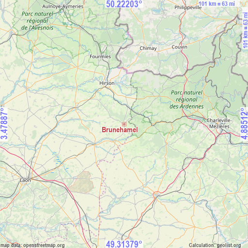
Brunehamel GPS coordinates[2]
49° 46' 12.144" North, 4° 10' 55.2" East
| Map corner | latitude | longitude |
|---|---|---|
| Upper-left | 50.22203°, | 3.47887° |
| Center: | 49.77004°, | 4.182° |
| Lower-right: | 49.31379°, | 4.88512° |
| Map W x H: | 101×101 km | = 62.8×62.8mi |
| max Lat: | 51.07786° ⇑8% North |
| Brunehamel: | 49.77004° |
| min Lat: | ⇓92% South 41.3874° |
| min Long | Brunehamel | max Long |
| -5.08615° | 4.182° | 9.52242° |
| W 69.5%⇐ | ⇒30.5% E |
Elevation
Elevation of Brunehamel is 241 m = 791 ft, and this is 47.3 m = 155 ft above average elevation for this country.
| Max E: |
2333 m = 7654 ft | 26.2% |
| Brunehamel | 241 m 791 ft | |
| Avg. | 193.7 m = 635 ft | |
Min E: |
-1 m = -3 ft | 73.8% |
See also: France elevation on elevation.city.
Geographical zone
Brunehamel is located in North temperate zone (between Tropic of Cancer and the Arctic Circle). Distance of this North polar circle is 1867.3 km =1160.3 mi to North.| Distance of | km | miles | from Brunehamel |
|---|---|---|---|
| North Pole | 4473.2 | 2779.5 | to North |
| Arctic Circle | 1867.3 | 1160.3 | to North |
| Tropic Cancer | 2928 | 1819.4 | to South |
| Equator | 5533.9 | 3438.6 | to South |


Nearby cities:
15 places around Brunehamel: (largest is in red/bold)
• Any-Martin-Rieux
12.8 km =8 mi,  12°
12°
• Aubenton
7.6 km =4.7 mi, 12°
• Auvillers-les-Forges
16.4 km =10.2 mi,  50°
50°
• Buire
17.4 km =10.8 mi,  328°
328°
• Chaourse
15 km =9.3 mi,  241°
241°
• La Bouteille
17.9 km =11.1 mi,  303°
303°
• Landouzy-la-Ville
14 km =8.7 mi,  316°
316°
• Liart
11.5 km =7.1 mi,  91°
91°
• Montcornet
14.5 km =9 mi, 235°
• Origny-en-Thiérache
18.1 km =11.2 mi, 319°
• Plomion
12.4 km =7.7 mi,  290°
290°
• Rocquigny
10.1 km =6.3 mi,  151°
151°
• Rozoy-sur-Serre
7.7 km =4.8 mi,  209°
209°
• Saint-Michel
17 km =10.6 mi,  348°
348°
• Signy-le-Petit
16.3 km =10.1 mi,  25°
25°
Sources, notices
• [Note1] Compared only with cities in France existing in our database
• [Src1] Map data: © OpenStreetMap contributors (CC-BY-SA)
• [Src2] Other city data from geonames.org with taken over terms of usage.
• [Src3] Geographical zone / Annual Mean Temperature by Robert A. Rohde @ Wikipedia
