Brûlon geodata
Brûlon (Pays de la Loire) is a populated place; located in France in Europe/Paris (GMT+2) time zone. With population of 1,427 people, there are 6496 cities with bigger population in this country. Compared to other cities in France, 58.7% of cities are located further ↓South; 80.1% of cities are located further →East and 59.7% of cities have higher elevation than Brûlon. Note1
Administrative division(s):
- Level 1: Pays de la Loire
- Level 2: Sarthe
- Level 3: Arrondissement de La Flèche
- Level 4: Brûlon


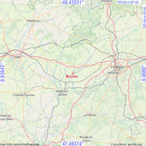
Brûlon GPS coordinates[2]
47° 58' 0.012" North, 0° 13' 59.988" West
| Map corner | latitude | longitude |
|---|---|---|
| Upper-left | 48.43531°, | -0.93645° |
| Center: | 47.96667°, | -0.23333° |
| Lower-right: | 47.49374°, | 0.4698° |
| Map W x H: | 104.7×104.7 km | = 65.1×65.1mi |
| max Lat: | 51.07786° ⇑41.3% North |
| Brûlon: | 47.96667° |
| min Lat: | ⇓58.7% South 41.3874° |
| min Long | Brûlon | max Long |
| -5.08615° | -0.23333° | 9.52242° |
| W 19.9%⇐ | ⇒80.1% E |
Elevation
Elevation of Brûlon is 103 m = 338 ft, and this is 90.7 m = 298 ft below average elevation for this country.
| Max E: |
2333 m = 7654 ft | 59.7% |
| Avg. | 193.7 m = 635 ft | |
| Brûlon | 103 m = 338 ft | |
Min E: |
-1 m = -3 ft | 40.3% |
See also: France elevation on elevation.city.
Geographical zone
Brûlon is located in North temperate zone (between Tropic of Cancer and the Arctic Circle). Distance of this North polar circle is 2067.8 km =1284.9 mi to North.| Distance of | km | miles | from Brûlon |
|---|---|---|---|
| North Pole | 4673.7 | 2904.1 | to North |
| Arctic Circle | 2067.8 | 1284.9 | to North |
| Tropic Cancer | 2727.5 | 1694.8 | to South |
| Equator | 5333.4 | 3314 | to South |


Nearby cities:
15 places around Brûlon: (largest is in red/bold)
• Auvers-le-Hamon
11.3 km =7 mi,  231°
231°
• Avoise
11.2 km =7 mi,  170°
170°
• Ballée
14.4 km =8.9 mi,  254°
254°
• Chantenay-Villedieu
7.4 km =4.6 mi,  133°
133°
• Joué-en-Charnie
6.5 km =4 mi,  29°
29°
• Juigné-sur-Sarthe
12 km =7.5 mi,  199°
199°
• Louplande
13.8 km =8.6 mi,  97°
97°
• Loué
6.7 km =4.2 mi,  61°
61°
• Noyen-sur-Sarthe
14.5 km =9 mi,  136°
136°
• Parcé-sur-Sarthe
13.9 km =8.6 mi, 170°
• Poillé-sur-Vègre
5.8 km =3.6 mi, 204°
• Saint-Symphorien
14.7 km =9.1 mi,  37°
37°
• Solesmes
13.8 km =8.6 mi, 200°
• Torcé-Viviers-en-Charnie
15 km =9.3 mi,  350°
350°
• Vallon-sur-Gée
12.3 km =7.6 mi,  91°
91°
Sources, notices
• [Note1] Compared only with cities in France existing in our database
• [Src1] Map data: © OpenStreetMap contributors (CC-BY-SA)
• [Src2] Other city data from geonames.org with taken over terms of usage.
• [Src3] Geographical zone / Annual Mean Temperature by Robert A. Rohde @ Wikipedia
