Ballée geodata
Ballée (Pays de la Loire) is a populated place; located in France in Europe/Paris (GMT+2) time zone. With population of 731 people, there are 11400 cities with bigger population in this country. Compared to other cities in France, 58.1% of cities are located further ↓South; 82.4% of cities are located further →East and 81.1% of cities have higher elevation than Ballée. Note1
Administrative division(s):
- Level 1: Pays de la Loire
- Level 2: Mayenne
- Level 3: Arrondissement de Château-Gontier
- Level 4: Val-du-Maine


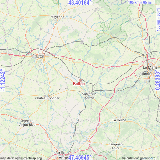
Ballée GPS coordinates[2]
47° 55' 57.684" North, 0° 25' 9.48" West
| Map corner | latitude | longitude |
|---|---|---|
| Upper-left | 48.40164°, | -1.12242° |
| Center: | 47.93269°, | -0.4193° |
| Lower-right: | 47.45945°, | 0.28383° |
| Map W x H: | 104.8×104.8 km | = 65.1×65.1mi |
| max Lat: | 51.07786° ⇑41.9% North |
| Ballée: | 47.93269° |
| min Lat: | ⇓58.1% South 41.3874° |
| min Long | Ballée | max Long |
| -5.08615° | -0.4193° | 9.52242° |
| W 17.6%⇐ | ⇒82.4% E |
Elevation
Elevation of Ballée is 52 m = 171 ft, and this is 141.7 m = 465 ft below average elevation for this country.
| Max E: |
2333 m = 7654 ft | 81.1% |
| Avg. | 193.7 m = 635 ft | |
| Ballée | 52 m = 171 ft | |
Min E: |
-1 m = -3 ft | 18.9% |
See also: France elevation on elevation.city.
Geographical zone
Ballée is located in North temperate zone (between Tropic of Cancer and the Arctic Circle). Distance of this North polar circle is 2071.6 km =1287.2 mi to North.| Distance of | km | miles | from Ballée |
|---|---|---|---|
| North Pole | 4677.4 | 2906.4 | to North |
| Arctic Circle | 2071.6 | 1287.2 | to North |
| Tropic Cancer | 2723.7 | 1692.4 | to South |
| Equator | 5329.6 | 3311.7 | to South |


Nearby cities:
15 places around Ballée: (largest is in red/bold)
• Arquenay
12.7 km =7.9 mi,  298°
298°
• Auvers-le-Hamon
6.1 km =3.8 mi,  123°
123°
• Bazougers
15.3 km =9.5 mi,  307°
307°
• Bierné
16.4 km =10.2 mi,  214°
214°
• Bouessay
6.6 km =4.1 mi,  164°
164°
• Bouère
8.9 km =5.5 mi, 208°
• Brûlon
14.4 km =8.9 mi,  74°
74°
• Grez-en-Bouère
10.1 km =6.3 mi,  229°
229°
• Juigné-sur-Sarthe
12.5 km =7.8 mi,  127°
127°
• Meslay-du-Maine
10.3 km =6.4 mi,  281°
281°
• Poillé-sur-Vègre
11.5 km =7.1 mi,  97°
97°
• Sablé-sur-Sarthe
12.4 km =7.7 mi,  148°
148°
• Solesmes
12.9 km =8 mi,  135°
135°
• Souvigné-sur-Sarthe
12 km =7.5 mi,  168°
168°
• Vaiges
12.7 km =7.9 mi,  340°
340°
Sources, notices
• [Note1] Compared only with cities in France existing in our database
• [Src1] Map data: © OpenStreetMap contributors (CC-BY-SA)
• [Src2] Other city data from geonames.org with taken over terms of usage.
• [Src3] Geographical zone / Annual Mean Temperature by Robert A. Rohde @ Wikipedia
