Aydoilles geodata
Aydoilles (Grand Est) is a populated place; located in France in Europe/Paris (GMT+2) time zone. With population of 1,095 people, there are 8159 cities with bigger population in this country. Compared to other cities in France, 63% of cities are located further ↓South; 92.2% of cities are located further ←West and 87.3% of cities have lower elevation than Aydoilles. Note1
Administrative division(s):
- Level 1: Grand Est
- Level 2: Vosges
- Level 3: Arrondissement d’Épinal
- Level 4: Aydoilles


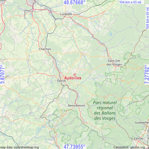
Aydoilles GPS coordinates[2]
48° 12' 36.936" North, 6° 34' 26.004" East
| Map corner | latitude | longitude |
|---|---|---|
| Upper-left | 48.67668°, | 5.87077° |
| Center: | 48.21026°, | 6.57389° |
| Lower-right: | 47.73955°, | 7.27702° |
| Map W x H: | 104.2×104.2 km | = 64.7×64.7mi |
| max Lat: | 51.07786° ⇑37% North |
| Aydoilles: | 48.21026° |
| min Lat: | ⇓63% South 41.3874° |
| min Long | Aydoilles | max Long |
| -5.08615° | 6.57389° | 9.52242° |
| W 92.2%⇐ | ⇒7.8% E |
Elevation
Elevation of Aydoilles is 378 m = 1240 ft, and this is 184.3 m = 605 ft above average elevation for this country.
| Max E: |
2333 m = 7654 ft | 12.7% |
| Aydoilles | 378 m 1240 ft | |
| Avg. | 193.7 m = 635 ft | |
Min E: |
-1 m = -3 ft | 87.3% |
See also: France elevation on elevation.city.
Geographical zone
Aydoilles is located in North temperate zone (between Tropic of Cancer and the Arctic Circle). Distance of this North polar circle is 2040.7 km =1268 mi to North.| Distance of | km | miles | from Aydoilles |
|---|---|---|---|
| North Pole | 4646.6 | 2887.3 | to North |
| Arctic Circle | 2040.7 | 1268 | to North |
| Tropic Cancer | 2754.6 | 1711.6 | to South |
| Equator | 5360.5 | 3330.9 | to South |


Nearby cities:
15 places around Aydoilles: (largest is in red/bold)
• Arches
10.7 km =6.6 mi,  198°
198°
• Archettes
10.1 km =6.3 mi, 195°
• Bruyères
10.7 km =6.6 mi,  91°
91°
• Chavelot
10.4 km =6.5 mi,  285°
285°
• Cheniménil
8.2 km =5.1 mi,  164°
164°
• Deyvillers
4.5 km =2.8 mi,  255°
255°
• Docelles
7.8 km =4.8 mi, 158°
• Dogneville
8.6 km =5.3 mi,  279°
279°
• Golbey
10 km =6.2 mi, 261°
• Grandvillers
6.8 km =4.2 mi,  61°
61°
• Jeuxey
6.4 km =4 mi, 261°
• La Baffe
5.4 km =3.4 mi,  179°
179°
• Laval-sur-Vologne
10 km =6.2 mi,  102°
102°
• Lépanges-sur-Vologne
8.4 km =5.2 mi,  125°
125°
• Épinal
9.4 km =5.8 mi,  251°
251°
Sources, notices
• [Note1] Compared only with cities in France existing in our database
• [Src1] Map data: © OpenStreetMap contributors (CC-BY-SA)
• [Src2] Other city data from geonames.org with taken over terms of usage.
• [Src3] Geographical zone / Annual Mean Temperature by Robert A. Rohde @ Wikipedia
