Champ-le-Duc geodata
Champ-le-Duc (Grand Est) is a populated place; located in France in Europe/Paris (GMT+2) time zone. With population of 504 people, there are 15167 cities with bigger population in this country. Compared to other cities in France, 62.8% of cities are located further ↓South; 93.2% of cities are located further ←West and 90.8% of cities have lower elevation than Champ-le-Duc. Note1
Administrative division(s):
- Level 1: Grand Est
- Level 2: Vosges
- Level 3: Arrondissement d’Épinal
- Level 4: Champ-le-Duc


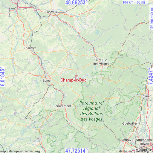
Champ-le-Duc GPS coordinates[2]
48° 11' 45.528" North, 6° 43' 17.688" East
| Map corner | latitude | longitude |
|---|---|---|
| Upper-left | 48.66253°, | 6.01845° |
| Center: | 48.19598°, | 6.72158° |
| Lower-right: | 47.72514°, | 7.4247° |
| Map W x H: | 104.2×104.2 km | = 64.7×64.7mi |
| max Lat: | 51.07786° ⇑37.2% North |
| Champ-le-Duc: | 48.19598° |
| min Lat: | ⇓62.8% South 41.3874° |
| min Long | Champ-le-Duc | max Long |
| -5.08615° | 6.72158° | 9.52242° |
| W 93.2%⇐ | ⇒6.8% E |
Elevation
Elevation of Champ-le-Duc is 444 m = 1457 ft, and this is 250.3 m = 821 ft above average elevation for this country.
| Max E: |
2333 m = 7654 ft | 9.2% |
| Champ-le-Duc | 444 m 1457 ft | |
| Avg. | 193.7 m = 635 ft | |
Min E: |
-1 m = -3 ft | 90.8% |
See also: France elevation on elevation.city.
Geographical zone
Champ-le-Duc is located in North temperate zone (between Tropic of Cancer and the Arctic Circle). Distance of this North polar circle is 2042.3 km =1269 mi to North.| Distance of | km | miles | from Champ-le-Duc |
|---|---|---|---|
| North Pole | 4648.2 | 2888.3 | to North |
| Arctic Circle | 2042.3 | 1269 | to North |
| Tropic Cancer | 2753 | 1710.6 | to South |
| Equator | 5358.9 | 3329.9 | to South |


Nearby cities:
15 places around Champ-le-Duc: (largest is in red/bold)
• Aydoilles
11.1 km =6.9 mi,  278°
278°
• Brouvelieures
4.6 km =2.9 mi,  8°
8°
• Bruyères
1.3 km =0.8 mi,  349°
349°
• Cheniménil
10.8 km =6.7 mi,  234°
234°
• Corcieux
12.1 km =7.5 mi,  102°
102°
• Docelles
9.9 km =6.2 mi, 234°
• Grandvillers
6.9 km =4.3 mi,  314°
314°
• Granges-sur-Vologne
7.6 km =4.7 mi,  137°
137°
• La Baffe
11.6 km =7.2 mi,  250°
250°
• La Houssière
9.7 km =6 mi,  90°
90°
• Laval-sur-Vologne
1.3 km =0.8 mi, 246°
• Laveline-devant-Bruyères
2.8 km =1.7 mi,  106°
106°
• Le Tholy
12.7 km =7.9 mi,  172°
172°
• Lépanges-sur-Vologne
5.2 km =3.2 mi, 231°
• Éloyes
13.8 km =8.6 mi,  218°
218°
Sources, notices
• [Note1] Compared only with cities in France existing in our database
• [Src1] Map data: © OpenStreetMap contributors (CC-BY-SA)
• [Src2] Other city data from geonames.org with taken over terms of usage.
• [Src3] Geographical zone / Annual Mean Temperature by Robert A. Rohde @ Wikipedia
