Bruyères geodata
Bruyères (Grand Est) is a populated place; located in France in Europe/Paris (GMT+2) time zone. With population of 3,423 people, there are 2843 cities with bigger population in this country. Compared to other cities in France, 63% of cities are located further ↓South; 93.1% of cities are located further ←West and 92% of cities have lower elevation than Bruyères. Note1
Administrative division(s):
- Level 1: Grand Est
- Level 2: Vosges
- Level 3: Arrondissement d’Épinal
- Level 4: Bruyères


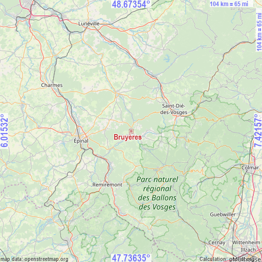
Bruyères GPS coordinates[2]
48° 12' 25.524" North, 6° 43' 6.42" East
| Map corner | latitude | longitude |
|---|---|---|
| Upper-left | 48.67354°, | 6.01532° |
| Center: | 48.20709°, | 6.71845° |
| Lower-right: | 47.73635°, | 7.42157° |
| Map W x H: | 104.2×104.2 km | = 64.7×64.7mi |
| max Lat: | 51.07786° ⇑37% North |
| Bruyères: | 48.20709° |
| min Lat: | ⇓63% South 41.3874° |
| min Long | Bruyères | max Long |
| -5.08615° | 6.71845° | 9.52242° |
| W 93.1%⇐ | ⇒6.9% E |
Elevation
Elevation of Bruyères is 477 m = 1565 ft, and this is 283.3 m = 929 ft above average elevation for this country.
| Max E: |
2333 m = 7654 ft | 8% |
| Bruyères | 477 m 1565 ft | |
| Avg. | 193.7 m = 635 ft | |
Min E: |
-1 m = -3 ft | 92% |
See also: France elevation on elevation.city.
Geographical zone
Bruyères is located in North temperate zone (between Tropic of Cancer and the Arctic Circle). Distance of this North polar circle is 2041 km =1268.2 mi to North.| Distance of | km | miles | from Bruyères |
|---|---|---|---|
| North Pole | 4646.9 | 2887.4 | to North |
| Arctic Circle | 2041 | 1268.2 | to North |
| Tropic Cancer | 2754.2 | 1711.4 | to South |
| Equator | 5360.1 | 3330.6 | to South |


Nearby cities:
15 places around Bruyères: (largest is in red/bold)
• Aydoilles
10.7 km =6.6 mi,  271°
271°
• Brouvelieures
3.4 km =2.1 mi,  15°
15°
• Champ-le-Duc
1.3 km =0.8 mi,  169°
169°
• Cheniménil
11.4 km =7.1 mi,  228°
228°
• Corcieux
12.7 km =7.9 mi,  107°
107°
• Docelles
10.5 km =6.5 mi, 228°
• Grandvillers
5.9 km =3.7 mi,  306°
306°
• Granges-sur-Vologne
8.7 km =5.4 mi,  142°
142°
• La Baffe
11.8 km =7.3 mi,  244°
244°
• La Bourgonce
14.1 km =8.8 mi,  34°
34°
• La Houssière
10 km =6.2 mi,  97°
97°
• Laval-sur-Vologne
2 km =1.2 mi,  208°
208°
• Laveline-devant-Bruyères
3.5 km =2.2 mi,  124°
124°
• Le Tholy
14 km =8.7 mi, 172°
• Lépanges-sur-Vologne
5.9 km =3.7 mi,  220°
220°
Sources, notices
• [Note1] Compared only with cities in France existing in our database
• [Src1] Map data: © OpenStreetMap contributors (CC-BY-SA)
• [Src2] Other city data from geonames.org with taken over terms of usage.
• [Src3] Geographical zone / Annual Mean Temperature by Robert A. Rohde @ Wikipedia
