Brégnier-Cordon geodata
Brégnier-Cordon (Auvergne-Rhône-Alpes) is a populated place; located in France in Europe/Paris (GMT+2) time zone. With population of 615 people, there are 13071 cities with bigger population in this country. Compared to other cities in France, 71.9% of cities are located further ↑North; 83.9% of cities are located further ←West and 77.4% of cities have lower elevation than Brégnier-Cordon. Note1
Administrative division(s):
- Level 1: Auvergne-Rhône-Alpes
- Level 2: Département de l'Ain
- Level 3: Arrondissement de Belley
- Level 4: Brégnier-Cordon


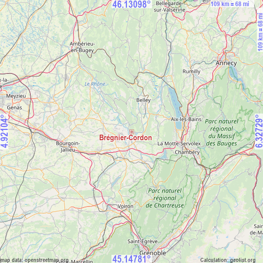
Brégnier-Cordon GPS coordinates[2]
45° 38' 29.58" North, 5° 37' 27.012" East
| Map corner | latitude | longitude |
|---|---|---|
| Upper-left | 46.13098°, | 4.92104° |
| Center: | 45.64155°, | 5.62417° |
| Lower-right: | 45.14781°, | 6.32729° |
| Map W x H: | 109.3×109.3 km | = 67.9×67.9mi |
| max Lat: | 51.07786° ⇑71.9% North |
| Brégnier-Cordon: | 45.64155° |
| min Lat: | ⇓28.1% South 41.3874° |
| min Long | Brégnier-Cordo | max Long |
| -5.08615° | 5.62417° | 9.52242° |
| W 83.9%⇐ | ⇒16.1% E |
Elevation
Elevation of Brégnier-Cordon is 267 m = 876 ft, and this is 73.3 m = 240 ft above average elevation for this country.
| Max E: |
2333 m = 7654 ft | 22.6% |
| Brégnier-Cordon | 267 m 876 ft | |
| Avg. | 193.7 m = 635 ft | |
Min E: |
-1 m = -3 ft | 77.4% |
See also: France elevation on elevation.city.
Geographical zone
Brégnier-Cordon is located in North temperate zone (between Tropic of Cancer and the Arctic Circle). Distance of this North polar circle is 2326.3 km =1445.5 mi to North.| Distance of | km | miles | from Brégnier-Cordon |
|---|---|---|---|
| North Pole | 4932.2 | 3064.7 | to North |
| Arctic Circle | 2326.3 | 1445.5 | to North |
| Tropic Cancer | 2468.9 | 1534.1 | to South |
| Equator | 5074.9 | 3153.4 | to South |


Nearby cities:
15 places around Brégnier-Cordon: (largest is in red/bold)
• Aoste
5.4 km =3.4 mi,  194°
194°
• Brangues
9.3 km =5.8 mi,  308°
308°
• Brens
11.2 km =7 mi,  27°
27°
• Chimilin
7.7 km =4.8 mi,  196°
196°
• Corbelin
7.4 km =4.6 mi,  239°
239°
• Curtin
10.4 km =6.5 mi,  271°
271°
• Faverges-de-la-Tour
9.8 km =6.1 mi,  234°
234°
• La Bâtie-Montgascon
10.3 km =6.4 mi, 226°
• Le Bouchage
8.7 km =5.4 mi,  293°
293°
• Les Avenières
4.9 km =3 mi,  263°
263°
• Romagnieu
8 km =5 mi,  170°
170°
• Saint-Benoît
6.5 km =4 mi,  335°
335°
• Saint-Genix-sur-Guiers
4.9 km =3 mi, 169°
• Thuellin
9 km =5.6 mi, 268°
• Virignin
11 km =6.8 mi,  38°
38°
Sources, notices
• [Note1] Compared only with cities in France existing in our database
• [Src1] Map data: © OpenStreetMap contributors (CC-BY-SA)
• [Src2] Other city data from geonames.org with taken over terms of usage.
• [Src3] Geographical zone / Annual Mean Temperature by Robert A. Rohde @ Wikipedia
