Saint-Benoît geodata
Saint-Benoît (Auvergne-Rhône-Alpes) is a populated place; located in France in Europe/Paris (GMT+2) time zone. With population of 635 people, there are 12740 cities with bigger population in this country. Compared to other cities in France, 71% of cities are located further ↑North; 83.6% of cities are located further ←West and 82.4% of cities have lower elevation than Saint-Benoît. Note1
Administrative division(s):
- Level 1: Auvergne-Rhône-Alpes
- Level 2: Département de l'Ain
- Level 3: Arrondissement de Belley
- Level 4: Groslée-Saint-Benoit


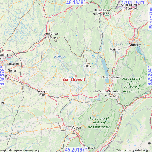
Saint-Benoît GPS coordinates[2]
45° 41' 41.784" North, 5° 35' 20.076" East
| Map corner | latitude | longitude |
|---|---|---|
| Upper-left | 46.1839°, | 4.88579° |
| Center: | 45.69494°, | 5.58891° |
| Lower-right: | 45.20167°, | 6.29204° |
| Map W x H: | 109.2×109.2 km | = 67.9×67.9mi |
| max Lat: | 51.07786° ⇑71% North |
| Saint-Benoît: | 45.69494° |
| min Lat: | ⇓29% South 41.3874° |
| min Long | Saint-Benoît | max Long |
| -5.08615° | 5.58891° | 9.52242° |
| W 83.6%⇐ | ⇒16.4% E |
Elevation
Elevation of Saint-Benoît is 314 m = 1030 ft, and this is 120.3 m = 395 ft above average elevation for this country.
| Max E: |
2333 m = 7654 ft | 17.6% |
| Saint-Benoît | 314 m 1030 ft | |
| Avg. | 193.7 m = 635 ft | |
Min E: |
-1 m = -3 ft | 82.4% |
See also: France elevation on elevation.city.
Geographical zone
Saint-Benoît is located in North temperate zone (between Tropic of Cancer and the Arctic Circle). Distance of this North polar circle is 2320.4 km =1441.8 mi to North.| Distance of | km | miles | from Saint-Benoît |
|---|---|---|---|
| North Pole | 4926.3 | 3061.1 | to North |
| Arctic Circle | 2320.4 | 1441.8 | to North |
| Tropic Cancer | 2474.9 | 1537.8 | to South |
| Equator | 5080.8 | 3157.1 | to South |


Nearby cities:
15 places around Saint-Benoît: (largest is in red/bold)
• Belley
10.5 km =6.5 mi,  47°
47°
• Brangues
4.5 km =2.8 mi,  268°
268°
• Brens
8.9 km =5.5 mi,  63°
63°
• Brégnier-Cordon
6.5 km =4 mi,  155°
155°
• Corbelin
10.4 km =6.5 mi,  200°
200°
• Creys-Mépieu
9.2 km =5.7 mi,  297°
297°
• Curtin
9.6 km =6 mi,  233°
233°
• Le Bouchage
5.8 km =3.6 mi,  244°
244°
• Les Avenières
6.9 km =4.3 mi, 198°
• Lhuis
6.6 km =4.1 mi,  323°
323°
• Morestel
9.8 km =6.1 mi,  259°
259°
• Saint-Sorlin-de-Morestel
10.6 km =6.6 mi, 232°
• Saint-Victor-de-Morestel
6.9 km =4.3 mi, 274°
• Thuellin
8.8 km =5.5 mi, 225°
• Virignin
10 km =6.2 mi,  74°
74°
Sources, notices
• [Note1] Compared only with cities in France existing in our database
• [Src1] Map data: © OpenStreetMap contributors (CC-BY-SA)
• [Src2] Other city data from geonames.org with taken over terms of usage.
• [Src3] Geographical zone / Annual Mean Temperature by Robert A. Rohde @ Wikipedia
