Bourg-Saint-Christophe geodata
Bourg-Saint-Christophe (Auvergne-Rhône-Alpes) is a populated place; located in France in Europe/Paris (GMT+2) time zone. With population of 908 people, there are 9593 cities with bigger population in this country. Compared to other cities in France, 67.9% of cities are located further ↑North; 79.3% of cities are located further ←West and 71.8% of cities have lower elevation than Bourg-Saint-Christophe. Note1
Administrative division(s):
- Level 1: Auvergne-Rhône-Alpes
- Level 2: Département de l'Ain
- Level 3: Arrondissement de Belley
- Level 4: Bourg-Saint-Christophe
Current local time in Bourg-Saint-Christophe:
02:30 PM, SaturdayDifference from your time zone: hours


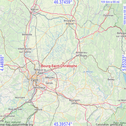
Bourg-Saint-Christophe GPS coordinates[2]
45° 53' 14.352" North, 5° 9' 0.36" East
| Map corner | latitude | longitude |
|---|---|---|
| Upper-left | 46.37459°, | 4.44698° |
| Center: | 45.88732°, | 5.1501° |
| Lower-right: | 45.39574°, | 5.85323° |
| Map W x H: | 108.8×108.8 km | = 67.6×67.6mi |
| max Lat: | 51.07786° ⇑67.9% North |
| Bourg-Saint-Christophe: | 45.88732° |
| min Lat: | ⇓32.1% South 41.3874° |
| min Long | Bourg-Saint-Chr | max Long |
| -5.08615° | 5.1501° | 9.52242° |
| W 79.3%⇐ | ⇒20.7% E |
Elevation
Elevation of Bourg-Saint-Christophe is 229 m = 751 ft, and this is 35.3 m = 116 ft above average elevation for this country.
| Max E: |
2333 m = 7654 ft | 28.2% |
| Bourg-Saint-Christophe | 229 m 751 ft | |
| Avg. | 193.7 m = 635 ft | |
Min E: |
-1 m = -3 ft | 71.8% |
See also: France elevation on elevation.city.
Geographical zone
Bourg-Saint-Christophe is located in North temperate zone (between Tropic of Cancer and the Arctic Circle). Distance of this North polar circle is 2299 km =1428.5 mi to North.| Distance of | km | miles | from Bourg-Saint-Christophe |
|---|---|---|---|
| North Pole | 4904.9 | 3047.8 | to North |
| Arctic Circle | 2299 | 1428.5 | to North |
| Tropic Cancer | 2496.3 | 1551.1 | to South |
| Equator | 5102.2 | 3170.4 | to South |


Nearby cities:
15 places around Bourg-Saint-Christophe: (largest is in red/bold)
• Balan
7.1 km =4.4 mi,  213°
213°
• Bressolles
4.7 km =2.9 mi,  242°
242°
• Béligneux
2.8 km =1.7 mi,  218°
218°
• Charnoz-sur-Ain
5.6 km =3.5 mi,  114°
114°
• Chazey-sur-Ain
8 km =5 mi,  85°
85°
• Dagneux
6.9 km =4.3 mi,  234°
234°
• Faramans
2.6 km =1.6 mi,  314°
314°
• Meximieux
4.5 km =2.8 mi,  58°
58°
• Montluel
8.2 km =5.1 mi, 241°
• Pizay
4.7 km =2.9 mi,  268°
268°
• Pérouges
2.8 km =1.7 mi,  47°
47°
• Rignieux-le-Franc
6.5 km =4 mi,  24°
24°
• Saint-Jean-de-Niost
7.9 km =4.9 mi,  139°
139°
• Saint-Maurice-de-Gourdans
8 km =5 mi,  154°
154°
• Sainte-Croix
7.5 km =4.7 mi,  275°
275°
Sources, notices
• [Note1] Compared only with cities in France existing in our database
• [Src1] Map data: © OpenStreetMap contributors (CC-BY-SA)
• [Src2] Other city data from geonames.org with taken over terms of usage.
• [Src3] Geographical zone / Annual Mean Temperature by Robert A. Rohde @ Wikipedia
