Balan geodata
Balan (Auvergne-Rhône-Alpes) is a populated place; located in France in Europe/Paris (GMT+2) time zone. With population of 2,610 people, there are 3738 cities with bigger population in this country. Compared to other cities in France, 68.7% of cities are located further ↑North; 78.7% of cities are located further ←West and 65.2% of cities have lower elevation than Balan. Note1
Administrative division(s):
- Level 1: Auvergne-Rhône-Alpes
- Level 2: Département de l'Ain
- Level 3: Arrondissement de Bourg-en-Bresse
- Level 4: Balan


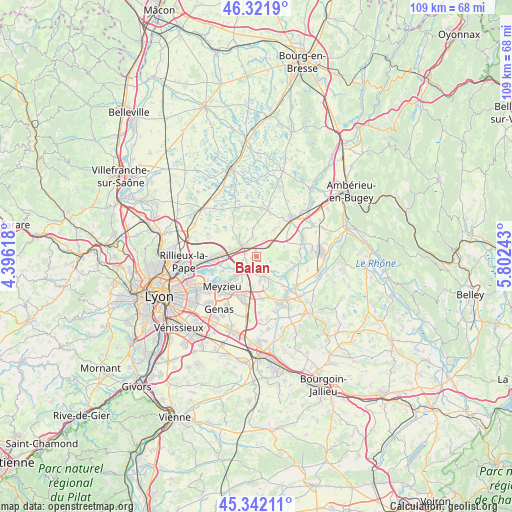
Balan GPS coordinates[2]
45° 50' 2.976" North, 5° 5' 57.48" East
| Map corner | latitude | longitude |
|---|---|---|
| Upper-left | 46.3219°, | 4.39618° |
| Center: | 45.83416°, | 5.0993° |
| Lower-right: | 45.34211°, | 5.80243° |
| Map W x H: | 108.9×108.9 km | = 67.7×67.7mi |
| max Lat: | 51.07786° ⇑68.7% North |
| Balan: | 45.83416° |
| min Lat: | ⇓31.3% South 41.3874° |
| min Long | Balan | max Long |
| -5.08615° | 5.0993° | 9.52242° |
| W 78.7%⇐ | ⇒21.3% E |
Elevation
Elevation of Balan is 195 m = 640 ft, and this is 1.3 m = 4 ft above average elevation for this country.
| Max E: |
2333 m = 7654 ft | 34.8% |
| Balan | 195 m 640 ft | |
| Avg. | 193.7 m = 635 ft | |
Min E: |
-1 m = -3 ft | 65.2% |
See also: France elevation on elevation.city.
Geographical zone
Balan is located in North temperate zone (between Tropic of Cancer and the Arctic Circle). Distance of this North polar circle is 2304.9 km =1432.2 mi to North.| Distance of | km | miles | from Balan |
|---|---|---|---|
| North Pole | 4910.8 | 3051.4 | to North |
| Arctic Circle | 2304.9 | 1432.2 | to North |
| Tropic Cancer | 2490.4 | 1547.5 | to South |
| Equator | 5096.3 | 3166.7 | to South |


Nearby cities:
15 places around Balan: (largest is in red/bold)
• Anthon
7.3 km =4.5 mi,  131°
131°
• Beynost
7.8 km =4.8 mi,  271°
271°
• Bourg-Saint-Christophe
7.1 km =4.4 mi,  33°
33°
• Bressolles
3.7 km =2.3 mi,  356°
356°
• Béligneux
4.3 km =2.7 mi, 30°
• Dagneux
2.5 km =1.6 mi,  319°
319°
• Jonage
5.9 km =3.7 mi,  224°
224°
• Jons
3.2 km =2 mi,  206°
206°
• La Boisse
5 km =3.1 mi,  281°
281°
• Montluel
3.8 km =2.4 mi,  301°
301°
• Niévroz
3.1 km =1.9 mi,  252°
252°
• Pizay
5.9 km =3.7 mi,  352°
352°
• Saint-Maurice-de-Gourdans
7.5 km =4.7 mi,  99°
99°
• Sainte-Croix
7.6 km =4.7 mi,  331°
331°
• Thil
6.3 km =3.9 mi, 248°
Sources, notices
• [Note1] Compared only with cities in France existing in our database
• [Src1] Map data: © OpenStreetMap contributors (CC-BY-SA)
• [Src2] Other city data from geonames.org with taken over terms of usage.
• [Src3] Geographical zone / Annual Mean Temperature by Robert A. Rohde @ Wikipedia
