Bonnières-sur-Seine geodata
Bonnières-sur-Seine (Île-de-France) is a populated place; located in France in Europe/Paris (GMT+2) time zone. With population of 4,187 people, there are 2346 cities with bigger population in this country. Compared to other cities in France, 80.5% of cities are located further ↓South; 62% of cities are located further →East and 90.3% of cities have higher elevation than Bonnières-sur-Seine. Note1
Administrative division(s):
- Level 1: Île-de-France
- Level 2: Yvelines
- Level 3: Arrondissement de Mantes-la-Jolie
- Level 4: Bonnières-sur-Seine


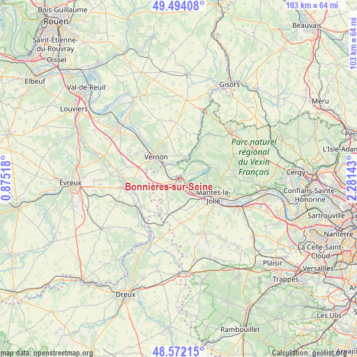
Bonnières-sur-Seine GPS coordinates[2]
49° 2' 6.9" North, 1° 34' 41.88" East
| Map corner | latitude | longitude |
|---|---|---|
| Upper-left | 49.49408°, | 0.87518° |
| Center: | 49.03525°, | 1.5783° |
| Lower-right: | 48.57215°, | 2.28143° |
| Map W x H: | 102.5×102.5 km | = 63.7×63.7mi |
| max Lat: | 51.07786° ⇑19.5% North |
| Bonnières-sur-Seine: | 49.03525° |
| min Lat: | ⇓80.5% South 41.3874° |
| min Long | Bonnières-sur- | max Long |
| -5.08615° | 1.5783° | 9.52242° |
| W 38%⇐ | ⇒62% E |
Elevation
Elevation of Bonnières-sur-Seine is 29 m = 95 ft, and this is 164.7 m = 540 ft below average elevation for this country.
| Max E: |
2333 m = 7654 ft | 90.3% |
| Avg. | 193.7 m = 635 ft | |
| Bonnières-sur-Seine | 29 m = 95 ft | |
Min E: |
-1 m = -3 ft | 9.7% |
See also: France elevation on elevation.city.
Geographical zone
Bonnières-sur-Seine is located in North temperate zone (between Tropic of Cancer and the Arctic Circle). Distance of this North polar circle is 1949 km =1211.1 mi to North.| Distance of | km | miles | from Bonnières-sur-Seine |
|---|---|---|---|
| North Pole | 4554.9 | 2830.3 | to North |
| Arctic Circle | 1949 | 1211.1 | to North |
| Tropic Cancer | 2846.3 | 1768.6 | to South |
| Equator | 5452.2 | 3387.8 | to South |


Nearby cities:
15 places around Bonnières-sur-Seine: (largest is in red/bold)
• Bennecourt
1.9 km =1.2 mi,  291°
291°
• Blaru
7.3 km =4.5 mi,  281°
281°
• Freneuse
2.2 km =1.4 mi,  49°
49°
• Gasny
6.6 km =4.1 mi,  16°
16°
• Giverny
5.8 km =3.6 mi,  322°
322°
• Gommecourt
5.6 km =3.5 mi, 16°
• Guernes
5 km =3.1 mi,  122°
122°
• La Roche-Guyon
6.4 km =4 mi,  36°
36°
• La Villeneuve-en-Chevrie
4.4 km =2.7 mi,  238°
238°
• Limetz-Villez
4.1 km =2.5 mi,  329°
329°
• Lommoye
6.6 km =4.1 mi,  225°
225°
• Moisson
7.8 km =4.8 mi,  57°
57°
• Mousseaux-sur-Seine
5.1 km =3.2 mi,  78°
78°
• Rosny-sur-Seine
5.7 km =3.5 mi,  136°
136°
• Sainte-Geneviève-lès-Gasny
5.3 km =3.3 mi,  5°
5°
Sources, notices
• [Note1] Compared only with cities in France existing in our database
• [Src1] Map data: © OpenStreetMap contributors (CC-BY-SA)
• [Src2] Other city data from geonames.org with taken over terms of usage.
• [Src3] Geographical zone / Annual Mean Temperature by Robert A. Rohde @ Wikipedia
