La Villeneuve-en-Chevrie geodata
La Villeneuve-en-Chevrie (Île-de-France) is a populated place; located in France in Europe/Paris (GMT+2) time zone. With population of 566 people, there are 13895 cities with bigger population in this country. Compared to other cities in France, 80% of cities are located further ↓South; 62.7% of cities are located further →East and 51.1% of cities have lower elevation than La Villeneuve-en-Chevrie. Note1
Administrative division(s):
- Level 1: Île-de-France
- Level 2: Yvelines
- Level 3: Arrondissement de Mantes-la-Jolie
- Level 4: La Villeneuve-en-Chevrie
Current local time in La Villeneuve-en-Chevrie:
10:00 AM, SaturdayDifference from your time zone: hours


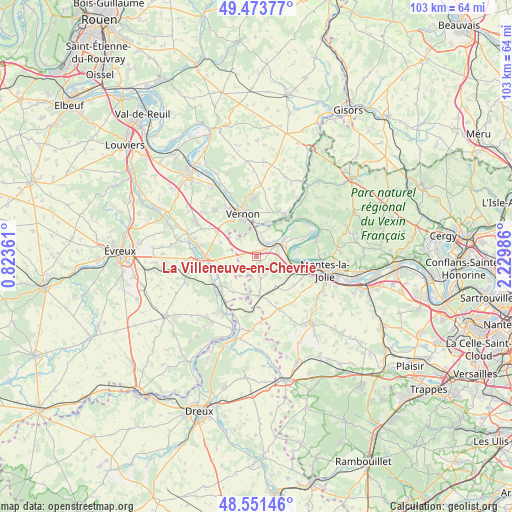
La Villeneuve-en-Chevrie GPS coordinates[2]
49° 0' 53.1" North, 1° 31' 36.264" East
| Map corner | latitude | longitude |
|---|---|---|
| Upper-left | 49.47377°, | 0.82361° |
| Center: | 49.01475°, | 1.52674° |
| Lower-right: | 48.55146°, | 2.22986° |
| Map W x H: | 102.6×102.5 km | = 63.8×63.7mi |
| max Lat: | 51.07786° ⇑20% North |
| La Villeneuve-en-Chevrie: | 49.01475° |
| min Lat: | ⇓80% South 41.3874° |
| min Long | La Villeneuve-e | max Long |
| -5.08615° | 1.52674° | 9.52242° |
| W 37.3%⇐ | ⇒62.7% E |
Elevation
Elevation of La Villeneuve-en-Chevrie is 136 m = 446 ft, and this is 57.7 m = 189 ft below average elevation for this country.
| Max E: |
2333 m = 7654 ft | 48.9% |
| Avg. | 193.7 m = 635 ft | |
| La Villeneuve-en-Chevrie | 136 m = 446 ft | |
Min E: |
-1 m = -3 ft | 51.1% |
See also: France elevation on elevation.city.
Geographical zone
La Villeneuve-en-Chevrie is located in North temperate zone (between Tropic of Cancer and the Arctic Circle). Distance of this North polar circle is 1951.2 km =1212.4 mi to North.| Distance of | km | miles | from La Villeneuve-en-Chevrie |
|---|---|---|---|
| North Pole | 4557.1 | 2831.6 | to North |
| Arctic Circle | 1951.2 | 1212.4 | to North |
| Tropic Cancer | 2844 | 1767.2 | to South |
| Equator | 5449.9 | 3386.4 | to South |


Nearby cities:
15 places around La Villeneuve-en-Chevrie: (largest is in red/bold)
• Bennecourt
3.6 km =2.2 mi,  34°
34°
• Blaru
5.1 km =3.2 mi,  317°
317°
• Boissy-Mauvoisin
6.9 km =4.3 mi,  146°
146°
• Bonnières-sur-Seine
4.4 km =2.7 mi,  58°
58°
• Breuilpont
9.1 km =5.7 mi,  231°
231°
• Bréval
7.7 km =4.8 mi,  176°
176°
• Freneuse
6.6 km =4.1 mi, 55°
• Giverny
6.9 km =4.3 mi,  1°
1°
• Gommecourt
9.3 km =5.8 mi, 34°
• Guernes
8 km =5 mi,  92°
92°
• Limetz-Villez
6 km =3.7 mi,  16°
16°
• Lommoye
2.6 km =1.6 mi,  203°
203°
• Rosny-sur-Seine
7.8 km =4.8 mi,  103°
103°
• Sainte-Geneviève-lès-Gasny
8.7 km =5.4 mi, 29°
• Villiers-en-Désœuvre
7.5 km =4.7 mi, 195°
Sources, notices
• [Note1] Compared only with cities in France existing in our database
• [Src1] Map data: © OpenStreetMap contributors (CC-BY-SA)
• [Src2] Other city data from geonames.org with taken over terms of usage.
• [Src3] Geographical zone / Annual Mean Temperature by Robert A. Rohde @ Wikipedia
