Gasny geodata
Gasny (Normandy) is a populated place; located in France in Europe/Paris (GMT+2) time zone. With population of 3,093 people, there are 3153 cities with bigger population in this country. Compared to other cities in France, 81.9% of cities are located further ↓South; 61.7% of cities are located further →East and 91.2% of cities have higher elevation than Gasny. Note1
Administrative division(s):
- Level 1: Normandy
- Level 2: Département de l'Eure
- Level 3: Les Andelys
- Level 4: Gasny


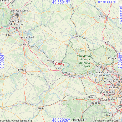
Gasny GPS coordinates[2]
49° 5' 30.624" North, 1° 36' 12.096" East
| Map corner | latitude | longitude |
|---|---|---|
| Upper-left | 49.55015°, | 0.90024° |
| Center: | 49.09184°, | 1.60336° |
| Lower-right: | 48.62926°, | 2.30649° |
| Map W x H: | 102.4×102.4 km | = 63.6×63.6mi |
| max Lat: | 51.07786° ⇑18.1% North |
| Gasny: | 49.09184° |
| min Lat: | ⇓81.9% South 41.3874° |
| min Long | Gasny | max Long |
| -5.08615° | 1.60336° | 9.52242° |
| W 38.3%⇐ | ⇒61.7% E |
Elevation
Elevation of Gasny is 27 m = 89 ft, and this is 166.7 m = 547 ft below average elevation for this country.
| Max E: |
2333 m = 7654 ft | 91.2% |
| Avg. | 193.7 m = 635 ft | |
| Gasny | 27 m = 89 ft | |
Min E: |
-1 m = -3 ft | 8.8% |
See also: France elevation on elevation.city.
Geographical zone
Gasny is located in North temperate zone (between Tropic of Cancer and the Arctic Circle). Distance of this North polar circle is 1942.7 km =1207.1 mi to North.| Distance of | km | miles | from Gasny |
|---|---|---|---|
| North Pole | 4548.6 | 2826.4 | to North |
| Arctic Circle | 1942.7 | 1207.1 | to North |
| Tropic Cancer | 2852.6 | 1772.5 | to South |
| Equator | 5458.5 | 3391.8 | to South |


Nearby cities:
15 places around Gasny: (largest is in red/bold)
• Bennecourt
6.6 km =4.1 mi,  212°
212°
• Bois-Jérôme-Saint-Ouen
5.2 km =3.2 mi,  284°
284°
• Bonnières-sur-Seine
6.6 km =4.1 mi,  196°
196°
• Bray-et-Lû
6.4 km =4 mi,  36°
36°
• Chaussy
7.2 km =4.5 mi,  62°
62°
• Fourges
4.2 km =2.6 mi, 39°
• Freneuse
4.8 km =3 mi,  181°
181°
• Giverny
5.6 km =3.5 mi,  252°
252°
• Gommecourt
1 km =0.6 mi,  194°
194°
• La Roche-Guyon
2.3 km =1.4 mi,  120°
120°
• Limetz-Villez
4.8 km =3 mi,  234°
234°
• Moisson
5.2 km =3.2 mi,  113°
113°
• Mousseaux-sur-Seine
6.2 km =3.9 mi,  148°
148°
• Sainte-Geneviève-lès-Gasny
1.7 km =1.1 mi, 233°
• Vétheuil
8 km =5 mi, 114°
Sources, notices
• [Note1] Compared only with cities in France existing in our database
• [Src1] Map data: © OpenStreetMap contributors (CC-BY-SA)
• [Src2] Other city data from geonames.org with taken over terms of usage.
• [Src3] Geographical zone / Annual Mean Temperature by Robert A. Rohde @ Wikipedia
