Langon geodata
Langon (Nouvelle-Aquitaine) is a seat of a third-order administrative division; located in France in Europe/Paris (GMT+2) time zone. With population of 7,102 people, there are 1372 cities with bigger population in this country. Compared to other cities in France, 83.2% of cities are located further ↑North; 80.2% of cities are located further →East and 97.8% of cities have higher elevation than Langon. Note1
Administrative division(s):
- Level 1: Nouvelle-Aquitaine
- Level 2: Gironde
- Level 3: Arrondissement de Langon
- Level 4: Langon


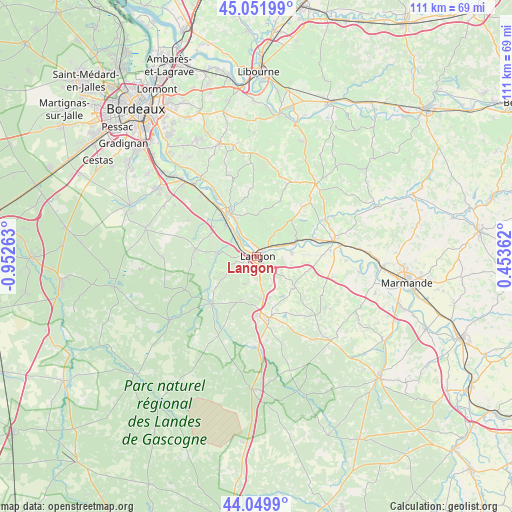
Langon GPS coordinates[2]
44° 33' 11.16" North, 0° 14' 58.236" West
| Map corner | latitude | longitude |
|---|---|---|
| Upper-left | 45.05199°, | -0.95263° |
| Center: | 44.5531°, | -0.24951° |
| Lower-right: | 44.0499°, | 0.45362° |
| Map W x H: | 111.4×111.4 km | = 69.2×69.2mi |
| max Lat: | 51.07786° ⇑83.2% North |
| Langon: | 44.5531° |
| min Lat: | ⇓16.8% South 41.3874° |
| min Long | Langon | max Long |
| -5.08615° | -0.24951° | 9.52242° |
| W 19.8%⇐ | ⇒80.2% E |
Elevation
Elevation of Langon is 9 m = 30 ft, and this is 184.7 m = 606 ft below average elevation for this country.
| Max E: |
2333 m = 7654 ft | 97.8% |
| Avg. | 193.7 m = 635 ft | |
| Langon | 9 m = 30 ft | |
Min E: |
-1 m = -3 ft | 2.2% |
See also: France elevation on elevation.city.
Geographical zone
Langon is located in North temperate zone (between Tropic of Cancer and the Arctic Circle). Distance of this Northern Tropic circle is 2347.9 km =1458.9 mi to South.| Distance of | km | miles | from Langon |
|---|---|---|---|
| North Pole | 5053.2 | 3139.9 | to North |
| Arctic Circle | 2447.3 | 1520.7 | to North |
| Tropic Cancer | 2347.9 | 1458.9 | to South |
| Equator | 4953.8 | 3078.1 | to South |


Nearby cities:
15 places around Langon: (largest is in red/bold)
• Barsac
8 km =5 mi,  319°
319°
• Castets-en-Dorthe
7.8 km =4.8 mi,  83°
83°
• Coimères
7.1 km =4.4 mi,  152°
152°
• Le Pian-sur-Garonne
4.6 km =2.9 mi,  38°
38°
• Mazères
6.5 km =4 mi,  186°
186°
• Preignac
5 km =3.1 mi,  314°
314°
• Roaillan
6.6 km =4.1 mi,  203°
203°
• Saint-Macaire
2.4 km =1.5 mi,  55°
55°
• Saint-Maixant
2.9 km =1.8 mi,  344°
344°
• Saint-Martin-de-Sescas
7.4 km =4.6 mi,  70°
70°
• Saint-Pierre-d’Aurillac
5.2 km =3.2 mi, 66°
• Sainte-Croix-du-Mont
4.9 km =3 mi, 338°
• Sauternes
7.7 km =4.8 mi,  253°
253°
• Toulenne
1.2 km =0.7 mi,  289°
289°
• Verdelais
4 km =2.5 mi,  359°
359°
Sources, notices
• [Note1] Compared only with cities in France existing in our database
• [Src1] Map data: © OpenStreetMap contributors (CC-BY-SA)
• [Src2] Other city data from geonames.org with taken over terms of usage.
• [Src3] Geographical zone / Annual Mean Temperature by Robert A. Rohde @ Wikipedia
