Béthisy-Saint-Pierre geodata
Béthisy-Saint-Pierre (Hauts-de-France) is a populated place; located in France in Europe/Paris (GMT+2) time zone. With population of 3,272 people, there are 2979 cities with bigger population in this country. Compared to other cities in France, 86.2% of cities are located further ↓South; 54.9% of cities are located further ←West and 76.2% of cities have higher elevation than Béthisy-Saint-Pierre. Note1
Administrative division(s):
- Level 1: Hauts-de-France
- Level 2: Département de l'Oise
- Level 3: Arrondissement de Senlis
- Level 4: Béthisy-Saint-Pierre


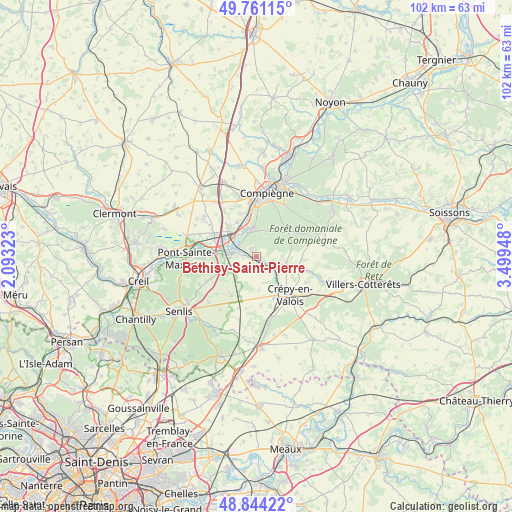
Béthisy-Saint-Pierre GPS coordinates[2]
49° 18' 17.352" North, 2° 47' 46.896" East
| Map corner | latitude | longitude |
|---|---|---|
| Upper-left | 49.76115°, | 2.09323° |
| Center: | 49.30482°, | 2.79636° |
| Lower-right: | 48.84422°, | 3.49948° |
| Map W x H: | 102×102 km | = 63.4×63.4mi |
| max Lat: | 51.07786° ⇑13.8% North |
| Béthisy-Saint-Pierre: | 49.30482° |
| min Lat: | ⇓86.2% South 41.3874° |
| min Long | Béthisy-Saint- | max Long |
| -5.08615° | 2.79636° | 9.52242° |
| W 54.9%⇐ | ⇒45.1% E |
Elevation
Elevation of Béthisy-Saint-Pierre is 64 m = 210 ft, and this is 129.7 m = 426 ft below average elevation for this country.
| Max E: |
2333 m = 7654 ft | 76.2% |
| Avg. | 193.7 m = 635 ft | |
| Béthisy-Saint-Pierre | 64 m = 210 ft | |
Min E: |
-1 m = -3 ft | 23.8% |
See also: France elevation on elevation.city.
Geographical zone
Béthisy-Saint-Pierre is located in North temperate zone (between Tropic of Cancer and the Arctic Circle). Distance of this North polar circle is 1919 km =1192.4 mi to North.| Distance of | km | miles | from Béthisy-Saint-Pierre |
|---|---|---|---|
| North Pole | 4524.9 | 2811.6 | to North |
| Arctic Circle | 1919 | 1192.4 | to North |
| Tropic Cancer | 2876.3 | 1787.2 | to South |
| Equator | 5482.2 | 3406.5 | to South |


Nearby cities:
15 places around Béthisy-Saint-Pierre: (largest is in red/bold)
• Armancourt
7.9 km =4.9 mi,  343°
343°
• Béthisy-Saint-Martin
1.9 km =1.2 mi,  126°
126°
• Gilocourt
6.1 km =3.8 mi,  103°
103°
• Lacroix-Saint-Ouen
5.8 km =3.6 mi,  354°
354°
• Le Meux
7.9 km =4.9 mi,  331°
331°
• Longueil-Sainte-Marie
8.1 km =5 mi,  315°
315°
• Néry
2.9 km =1.8 mi,  208°
208°
• Orrouy
4.7 km =2.9 mi,  109°
109°
• Rivecourt
6.5 km =4 mi, 317°
• Saint-Sauveur
1.8 km =1.1 mi, 328°
• Saint-Vaast-de-Longmont
4.3 km =2.7 mi,  267°
267°
• Saintines
2.3 km =1.4 mi,  278°
278°
• Trumilly
6.9 km =4.3 mi,  177°
177°
• Verberie
4.7 km =2.9 mi, 278°
• Villeneuve-sur-Verberie
8.4 km =5.2 mi,  246°
246°
Sources, notices
• [Note1] Compared only with cities in France existing in our database
• [Src1] Map data: © OpenStreetMap contributors (CC-BY-SA)
• [Src2] Other city data from geonames.org with taken over terms of usage.
• [Src3] Geographical zone / Annual Mean Temperature by Robert A. Rohde @ Wikipedia
