Pierrefeu-du-Var geodata
Pierrefeu-du-Var (Provence-Alpes-Côte d'Azur) is a populated place; located in France in Europe/Paris (GMT+2) time zone. With population of 4,818 people, there are 2057 cities with bigger population in this country. Compared to other cities in France, 96.9% of cities are located further ↑North; 88.8% of cities are located further ←West and 69.2% of cities have higher elevation than Pierrefeu-du-Var. Note1
Administrative division(s):
- Level 1: Provence-Alpes-Côte d'Azur
- Level 2: Var
- Level 3: Arrondissement de Toulon
- Level 4: Pierrefeu-du-Var


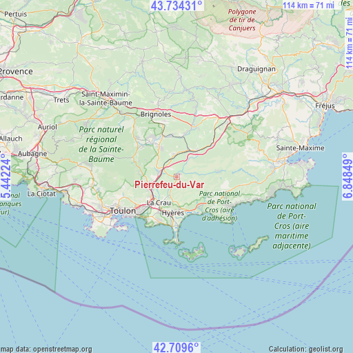
Pierrefeu-du-Var GPS coordinates[2]
43° 13' 26.796" North, 6° 8' 43.296" East
| Map corner | latitude | longitude |
|---|---|---|
| Upper-left | 43.73431°, | 5.44224° |
| Center: | 43.22411°, | 6.14536° |
| Lower-right: | 42.7096°, | 6.84849° |
| Map W x H: | 113.9×113.9 km | = 70.8×70.8mi |
| max Lat: | 51.07786° ⇑96.9% North |
| Pierrefeu-du-Var: | 43.22411° |
| min Lat: | ⇓3.1% South 41.3874° |
| min Long | Pierrefeu-du-Va | max Long |
| -5.08615° | 6.14536° | 9.52242° |
| W 88.8%⇐ | ⇒11.2% E |
Elevation
Elevation of Pierrefeu-du-Var is 80 m = 262 ft, and this is 113.7 m = 373 ft below average elevation for this country.
| Max E: |
2333 m = 7654 ft | 69.2% |
| Avg. | 193.7 m = 635 ft | |
| Pierrefeu-du-Var | 80 m = 262 ft | |
Min E: |
-1 m = -3 ft | 30.8% |
See also: France elevation on elevation.city.
Geographical zone
Pierrefeu-du-Var is located in North temperate zone (between Tropic of Cancer and the Arctic Circle). Distance of this Northern Tropic circle is 2200.2 km =1367.1 mi to South.| Distance of | km | miles | from Pierrefeu-du-Var |
|---|---|---|---|
| North Pole | 5201 | 3231.8 | to North |
| Arctic Circle | 2595.1 | 1612.5 | to North |
| Tropic Cancer | 2200.2 | 1367.1 | to South |
| Equator | 4806.1 | 2986.4 | to South |


Nearby cities:
15 places around Pierrefeu-du-Var: (largest is in red/bold)
• Belgentier
12.1 km =7.5 mi,  281°
281°
• Carnoules
9.3 km =5.8 mi,  21°
21°
• Collobrières
13.3 km =8.3 mi,  83°
83°
• Cuers
6.1 km =3.8 mi, 284°
• Hyères
11.6 km =7.2 mi,  186°
186°
• La Crau
10.1 km =6.3 mi,  214°
214°
• La Farlède
10.3 km =6.4 mi,  233°
233°
• La Londe-les-Maures
11.9 km =7.4 mi,  143°
143°
• Pignans
10.8 km =6.7 mi,  37°
37°
• Puget-Ville
7.3 km =4.5 mi,  354°
354°
• Rocbaron
10.8 km =6.7 mi,  330°
330°
• Sainte-Anastasie-sur-Issole
13.3 km =8.3 mi, 352°
• Solliès-Pont
9.3 km =5.8 mi,  245°
245°
• Solliès-Toucas
10 km =6.2 mi,  258°
258°
• Solliès-Ville
9.8 km =6.1 mi,  241°
241°
Sources, notices
• [Note1] Compared only with cities in France existing in our database
• [Src1] Map data: © OpenStreetMap contributors (CC-BY-SA)
• [Src2] Other city data from geonames.org with taken over terms of usage.
• [Src3] Geographical zone / Annual Mean Temperature by Robert A. Rohde @ Wikipedia
