Beaurepaire geodata
Beaurepaire (Pays de la Loire) is a populated place; located in France in Europe/Paris (GMT+2) time zone. With population of 1,676 people, there are 5589 cities with bigger population in this country. Compared to other cities in France, 56.2% of cities are located further ↑North; 89% of cities are located further →East and 63.2% of cities have higher elevation than Beaurepaire. Note1
Administrative division(s):
- Level 1: Pays de la Loire
- Level 2: Département de la Vendée
- Level 3: Arrondissement de La Roche-sur-Yon
- Level 4: Beaurepaire


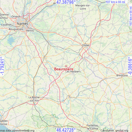
Beaurepaire GPS coordinates[2]
46° 54' 35.172" North, 1° 5' 21.408" West
| Map corner | latitude | longitude |
|---|---|---|
| Upper-left | 47.38796°, | -1.79241° |
| Center: | 46.90977°, | -1.08928° |
| Lower-right: | 46.42728°, | -0.38616° |
| Map W x H: | 106.8×106.8 km | = 66.4×66.4mi |
| max Lat: | 51.07786° ⇑56.2% North |
| Beaurepaire: | 46.90977° |
| min Lat: | ⇓43.8% South 41.3874° |
| min Long | Beaurepaire | max Long |
| -5.08615° | -1.08928° | 9.52242° |
| W 11%⇐ | ⇒89% E |
Elevation
Elevation of Beaurepaire is 94 m = 308 ft, and this is 99.7 m = 327 ft below average elevation for this country.
| Max E: |
2333 m = 7654 ft | 63.2% |
| Avg. | 193.7 m = 635 ft | |
| Beaurepaire | 94 m = 308 ft | |
Min E: |
-1 m = -3 ft | 36.8% |
See also: France elevation on elevation.city.
Geographical zone
Beaurepaire is located in North temperate zone (between Tropic of Cancer and the Arctic Circle). Distance of this North polar circle is 2185.3 km =1357.9 mi to North.| Distance of | km | miles | from Beaurepaire |
|---|---|---|---|
| North Pole | 4791.2 | 2977.1 | to North |
| Arctic Circle | 2185.3 | 1357.9 | to North |
| Tropic Cancer | 2610 | 1621.8 | to South |
| Equator | 5215.9 | 3241 | to South |


Nearby cities:
15 places around Beaurepaire: (largest is in red/bold)
• Bazoges-en-Paillers
3.6 km =2.2 mi,  266°
266°
• Chambretaud
9.6 km =6 mi,  82°
82°
• La Boissière-de-Montaigu
8.9 km =5.5 mi,  300°
300°
• La Gaubretière
4.1 km =2.5 mi,  30°
30°
• La Verrie
9.1 km =5.7 mi,  51°
51°
• Le Longeron
12.3 km =7.6 mi,  11°
11°
• Les Herbiers
7.3 km =4.5 mi,  130°
130°
• Les Landes-Genusson
6.7 km =4.2 mi,  341°
341°
• Mesnard-la-Barotière
5.7 km =3.5 mi,  187°
187°
• Saint-Aubin-des-Ormeaux
9.8 km =6.1 mi,  21°
21°
• Saint-Fulgent
9.3 km =5.8 mi,  226°
226°
• Saint-Martin-des-Tilleuls
7.7 km =4.8 mi, 23°
• Saint-Paul-en-Pareds
12.3 km =7.6 mi,  142°
142°
• Tiffauges
11.3 km =7 mi,  352°
352°
• Vendrennes
9.8 km =6.1 mi,  195°
195°
Sources, notices
• [Note1] Compared only with cities in France existing in our database
• [Src1] Map data: © OpenStreetMap contributors (CC-BY-SA)
• [Src2] Other city data from geonames.org with taken over terms of usage.
• [Src3] Geographical zone / Annual Mean Temperature by Robert A. Rohde @ Wikipedia
