Saint-Paul-en-Pareds geodata
Saint-Paul-en-Pareds (Pays de la Loire) is a populated place; located in France in Europe/Paris (GMT+2) time zone. With population of 1,005 people, there are 8801 cities with bigger population in this country. Compared to other cities in France, 57% of cities are located further ↑North; 88.1% of cities are located further →East and 54.8% of cities have higher elevation than Saint-Paul-en-Pareds. Note1
Administrative division(s):
- Level 1: Pays de la Loire
- Level 2: Département de la Vendée
- Level 3: Arrondissement de La Roche-sur-Yon
- Level 4: Saint-Paul-en-Pareds


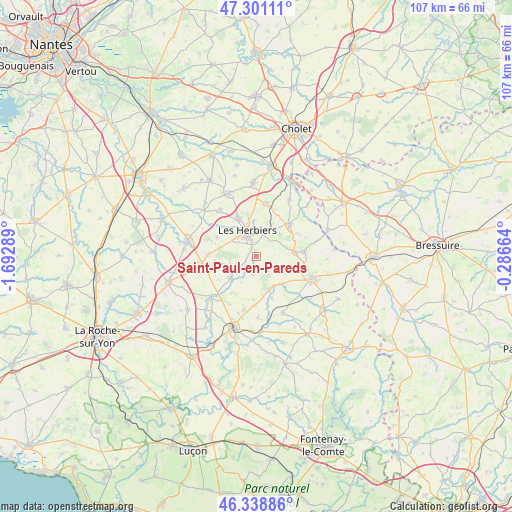
Saint-Paul-en-Pareds GPS coordinates[2]
46° 49' 19.704" North, 0° 59' 23.172" West
| Map corner | latitude | longitude |
|---|---|---|
| Upper-left | 47.30111°, | -1.69289° |
| Center: | 46.82214°, | -0.98977° |
| Lower-right: | 46.33886°, | -0.28664° |
| Map W x H: | 107×107 km | = 66.5×66.5mi |
| max Lat: | 51.07786° ⇑57% North |
| Saint-Paul-en-Pareds: | 46.82214° |
| min Lat: | ⇓43% South 41.3874° |
| min Long | Saint-Paul-en-P | max Long |
| -5.08615° | -0.98977° | 9.52242° |
| W 11.9%⇐ | ⇒88.1% E |
Elevation
Elevation of Saint-Paul-en-Pareds is 117 m = 384 ft, and this is 76.7 m = 252 ft below average elevation for this country.
| Max E: |
2333 m = 7654 ft | 54.8% |
| Avg. | 193.7 m = 635 ft | |
| Saint-Paul-en-Pareds | 117 m = 384 ft | |
Min E: |
-1 m = -3 ft | 45.2% |
See also: France elevation on elevation.city.
Geographical zone
Saint-Paul-en-Pareds is located in North temperate zone (between Tropic of Cancer and the Arctic Circle). Distance of this North polar circle is 2195 km =1363.9 mi to North.| Distance of | km | miles | from Saint-Paul-en-Pareds |
|---|---|---|---|
| North Pole | 4800.9 | 2983.1 | to North |
| Arctic Circle | 2195 | 1363.9 | to North |
| Tropic Cancer | 2600.2 | 1615.7 | to South |
| Equator | 5206.1 | 3234.9 | to South |


Nearby cities:
15 places around Saint-Paul-en-Pareds: (largest is in red/bold)
• Chambretaud
11.2 km =7 mi,  10°
10°
• La Flocellière
9.8 km =6.1 mi,  83°
83°
• Le Boupère
5.6 km =3.5 mi,  121°
121°
• Les Epesses
9.6 km =6 mi,  45°
45°
• Les Herbiers
5.4 km =3.4 mi,  337°
337°
• Mesnard-la-Barotière
9.2 km =5.7 mi,  296°
296°
• Monsireigne
9.2 km =5.7 mi,  160°
160°
• Mouchamps
7.1 km =4.4 mi,  230°
230°
• Rochetrejoux
3.7 km =2.3 mi,  187°
187°
• Saint-Germain-de-Prinçay
11.5 km =7.1 mi, 192°
• Saint-Mars-la-Réorthe
6.6 km =4.1 mi, 48°
• Saint-Michel-Mont-Mercure
8.2 km =5.1 mi, 84°
• Saint-Prouant
7.5 km =4.7 mi, 160°
• Saint-Vincent-Sterlanges
11.8 km =7.3 mi,  219°
219°
• Vendrennes
10.2 km =6.3 mi,  271°
271°
Sources, notices
• [Note1] Compared only with cities in France existing in our database
• [Src1] Map data: © OpenStreetMap contributors (CC-BY-SA)
• [Src2] Other city data from geonames.org with taken over terms of usage.
• [Src3] Geographical zone / Annual Mean Temperature by Robert A. Rohde @ Wikipedia
